Awards & Nominations
Pangaea has received the following awards and nominations. Way to go!
Global Nominee

Pangaea has received the following awards and nominations. Way to go!
Our project is an integrated approach of combining planetary science with VR technology and omnidirectional treadmill, which gives an individual a wholly interactive virtual environment and an immersive real-like experience of exploring and learning about the solar system. The technology and concepts used in the project enable us to enhance the enthusiasm and curiosity of the general public in research of the planets alongside ensuring the effective use of the data information available on NASA and other space agencies.
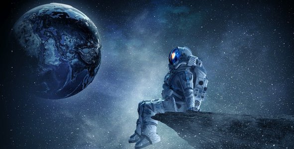
Homosapiens always had been the species who got a taste for adventure in the thrill of satisfying their insatiable curiosity. It doesn't matter whether you were a hunter-gatherer roaming in the plains of savannah or a modern-day Astronaut gazing at the Orion nebula from the International Space Station, you will always be on the lookout for adventure and exploration.
With the passing of time, Humanity grew more curious and hence more innovative and as history speaks, the fundamentals of scientific discoveries often come from the new ways of looking at things, whether in the sky or around us. With the cognizance of astounding feats that Humanity has achieved in the modern day of science and technology, We are hoping to bring a new perspective to the way we look at NASA, planetary science, and how it is all connected. Humans have always wondered about the world beneath the blue sky but only a few have reached there. We have developed a concept of connecting planetary science with advanced science and technology in order to develop a simulated as well as learning application that will enhance the understanding of earthlings about the actual planetary system in an adventurous way. It is a learning application that has aimed to satisfy the urge of the present generation regarding the unfamiliar interstellar world.
The Omni-Directional Treadmill (ODT) is a revolutionary device for locomotion in large-scale virtual environments. The device allows its user to walk or jog in any direction of travel. Whenever a small physical space must be mapped to a much larger virtual space (Like a planetary system )a mechanism must be provided to allow users to move over large distances in the virtual world without actually moving far in the physical space. For this fine movement over short distances such as side-stepping or turning in place must be involved. The ODT is a revolutionary locomotion device that enables bipedal locomotion in any direction of travel.
The ODT Works in synchrony With the VR system by sending velocity and direction signals to the image generated by the computer. The computer uses the velocity vector thus provided to update what is shown to the user so that the user sees a visual image Which takes into account this vector. For example, if the user’s velocity is 1/2 meter/sec in the X direction as indicated by the X-direction motion of the treadmill, the user will observe objects within the virtual world passing by at 1/2 meter/sec in the minus x-direction.
Now as we mentioned that we have taken the help of the NASA Science Mission Directorate which studies our home planet’s systems while exploring the worlds in our solar system and the elements of the larger universe. We have created the solution to connect the diverse NASA science disciplines and communicate those linkages in an innovative and interesting way to new and diverse audiences.
Exploratory missions throughout our solar system have made a large variety of planetary maps available to the public. GIS has helped us study our little corner of the universe in an effort to understand each body’s origin and study how they may have changed over time. Satellite mapping is allowing us to study extraterrestrial bodies from the comfort of home, offering a brand new view of these strange and distant worlds.
What is GIS?
A geographic information system (GIS) is a system that creates, manages, analyzes, and maps all types of data. GIS connects data to a map, integrating location data (where things are) with all types of descriptive information (what things are like there). This provides a foundation for mapping and analysis that is used in science and almost every industry. GIS helps users understand patterns, relationships, and geographic context. The benefits include improved communication and efficiency as well as better management and decision-making.
So, finally, we have collected all the resources available from NASA and other space agencies and managed the data at a website that is accessible to all of the general public. All the possible data are then simulated in a virtual reality which will provide an immersive virtual environment experience which we hope will help to boost scientific enthusiasm and curiosity among the general public.
Our project is based on the usage of images and videos of multiple celestial bodies of the solar system (i.e. Mars, Moon, Venus, etc.) and incorporating the environmental and atmospheric data for simulations. For the exclusive process of making VR a success, our project relies on photos, videos, and raw environmental data based on NASA’s and other space agencies’ orbital satellites, rovers, spacecraft, and their instruments.
For Instance, the compiled images of the Martian surface captured by Spirit, Opportunity, Curiosity, Perseverance, and other rovers would help us to create a 360-degree martian environment. Along with it, the sound captured by the rovers and the other information like marsquake, wind force, and others attuned with an omnidirectional treadmill would enable a whole new real-like experience to the user of being on the martian-surface.
Likewise, we would use data collected by Juno, Cassini, and other spacecraft to create the VR simulations of respective planets and let the audience be an astronaut or a native to the respective planet.
Virtual Explorers - Bringing the Solar System Down to Earth is our team effort and a unique approach to solve the problem of connecting multiple disciplines of space science and making them available for the public. NASA Space Apps Challenge brought us an opportunity to get united with like-minded hackers and pitchers. The challenge made us realize the amount of scientific data and resources that are available to the public and the potential they carry if utilized optimally. So, in a way to make the public aware of the works and deeds NASA and other space agencies are doing, we decided to accept the challenge ‘Discovering Science Connections.’
Overall, Our Space Apps journey was mesmerizing. Time limitation was the main problem yet the biggest opportunity for us. We had to develop our project and yet give our best ideas for the challenge within a limited time. This helped to enhance our problem-solving capacity and the capability to deal with intense pressure. We would like to thank NASA, NASO, and all the organizers who have made this possible and brought this campaign to us.
#VR #VirtualWorld #NASA #Explore #SolarSystem #Nepal #Pangaeaa #Hackathon
This project has been submitted for consideration during the Judging process.
The NASA Science Mission Directorate studies our home planet’s systems while exploring the worlds in our solar system and the elements of the larger universe. Your challenge is to find the connections between the diverse NASA science disciplines and communicate those linkages in an innovative and interesting way to new and diverse audiences.