
High-Level Project Summary
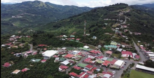
what we have developed was a website that provides information little known in the area of the effects caused by tectonic faults on roads and buildings, this is a solution to the challenge because if we knew where the volcanic faults pass and their extensions we could save travel costs and re-building and we could know through the use of drones where we can build and where not and the money that was invested in re-building could be invested in urban projects such as road maintenance and maintenance of the buildings of public institutions and allocate it to perish the damage caused by tectonic faults.And finally, it's important because it would greatly help urban development.
Link to Project "Demo"
Link to Final Project
Detailed Project Description
Our project works through a website that shares images, data and videos of the negative effects that tectonic faults can cause on infrastructure in general, taking as an example events that have occurred near my area of residence. The benefits it has are: savings for the government and civilians, because if you map where the faults pass, you will not be contravening there, avoiding damages due to land subsidence. What I hope to get a benefit in the community where I live. The tool I used to make the website was Wix.com, I did not use programming languages due to my limited knowledge in this sector, the software I used was Avast secure browser to search for information, and to develop the website I used Wix.com.
Space Agency Data
I used nasa WOLRDVIEW, I also Used nasa AIR CUALITY and nasa Giovanni.
Hackathon Journey
My experience was very good, I had many problems with my team and not because I wanted to, I learned a lot like to have a lot of patience and also to learn to interpret myself well. My focus was the problems generated by tectonic faults in the infrastructure of the area, I managed to solve the challenge through web reading articles and with the assistance of my parents, and some friends. I would like to thank first NASA for providing us with these tools, then my family and my cousin and also Alison because she helped me in terms of writing.
References
https://explorer.earthengine.google.com/#workspace
https://editor.wix.com
https://worldview.earthdata.nasa.gov/
https://www.hostinger.es/tutoriales/inspiracion-disenos-web
https://www.teletica.com/nacional/vecinos-de-frailes-en-desamparados-temen-quedar-incomunicados-por-mal-estado-de-la-calle_196054
https://www.deepl.com/es/translator#es/en/Posible%20protocolo%20de%20emergencia%20ante%20desastres%20naturales%3A
https://hidrogeotecnia.com/informacion/drones-y-sus-aplicaciones-en-la-geografia-y-en-la-ingenieria/
https://rsn.ucr.ac.cr/actividad-sismica/ultimos-sismos/57-sismologia/fallas-activas2/5039-falla-frailes-pirris-pangolin#:~:text=Es%20un%20sistema%20de%20falla,km%20al%20sur%20de%20Copey.&text=(1998)%20al%20extremo%20noroeste%20de,le%20conoc%C3%ADa%20como%20Falla%20Higuito.
https://rsn.ucr.ac.cr/actividad-sismica/fallas-activas
https://rsn.ucr.ac.cr/component/content/article/99-actividad-sismica/fallas-activas-ii/3059-falla-jaris?Itemid=225
https://enterprise-insights.dji.com/es/blog/utilizando-drones-para-mapeo-volcanes
https://youtu.be/-tJz54hAs4I
Tags
#sotware #web design #Team work
Global Judging
This project has been submitted for consideration during the Judging process.