Awards & Nominations
Drone For Disasters "DFD" has received the following awards and nominations. Way to go!
Global Nominee

Drone For Disasters "DFD" has received the following awards and nominations. Way to go!
Our idea aims to facilitate access to the disaster site and because of the obstacles and geographical terrain and the different size of natural disasters that occur, the use of drones to solve disaster problems is necessary to save human lives and property Use of geographic information systems and remote sensing The use of drones to assess, predict and manage risks for emergencies and how to best use technologies when disaster areas are inaccessible during emergencies Easily deploy drones to reach hard-to-reach areas Use it to obtain data during emergencies or that are impossible for rescue teams to implement. It also provides time-saving opportunities for first responders during emergencies
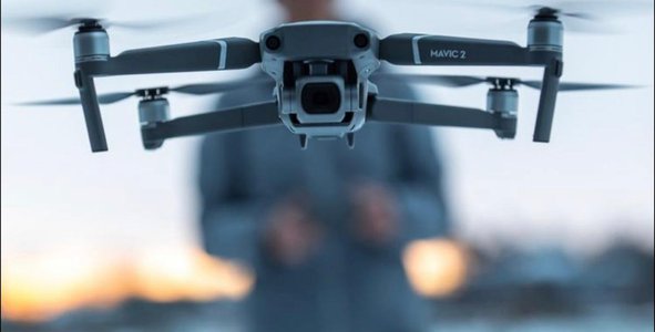
Developing the project to suit the task, which is to turn drones from commercial or intermediary into a means to assist and support the competent authorities in the task of discovering humans and animals stuck in the midst of disasters, by means of a thermal camera, and sending images and coordinates of the injured’s location to the control center. And direct the risk management team to make the mission a success. Entering the airport codes in the surrounding area to know the wind information and its direction to avoid the drone in the direction of the hot air coming out of the fire, and at the same time pumping water into the site and trying to put it out. Before its deployment, in the event of difficulty in reaching the Civil Defense and other authorities. This idea is based on reducing the loss of human and animal lives, preserving property, and preserving the environment from forests and air.
1-We used earth observatory - NASA- to develop our data
2- https://earthobservatory.nasa.gov/global-maps/MOD14A1_M_FIRE
3- https://www.nytimes.com/2020/09/16/us/california-fires-cost.amp.html
4-https://www.aviationweather.gov/metar/data?ids=Ksck&format=raw&date=&hours=0
5- https://www.fire.ca.gov/incidents/
experience of the Space Challenge Hackathon is a real challenge because of several factors, including (it brought together members from several cities who did not know each other three days before, in addition to the short duration of completion of the project. This is evidence of the team's skill in time management, and the presence of a motivation factor among us to make the task a success, so I thank all team members for their cooperation and for the clarity of our vision and the presence of the passion factor
.earth observatory - NASA
https://earthobservatory.nasa.gov/global-maps/MOD14A1_M_FIRE
This link open source use AI to determine human from thermal image:
https://github.com/cairangxianmu/Human-detection-model-based-on-thermal-and-depth-images#%E4%B8%8A%E6%89%8B%E6%8C%87%E5%8D%97
This project has been submitted for consideration during the Judging process.
Data from Earth-observing satellites, airborne science platforms, unmanned aerial vehicles (UAVs), and in situ platforms can be used to address development challenges around the world. Your challenge is to use this data to enable local stakeholders to develop more sustainable, disaster-risk resilient, and inclusive urban plans.