Awards & Nominations
JUNQI has received the following awards and nominations. Way to go!
Global Nominee

JUNQI has received the following awards and nominations. Way to go!
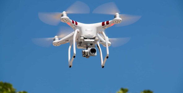
With population growth and unbridled consumption, a big problem comes into discussion: waste. With the growing production of waste, its correct collection and disposal becomes more important in order to reduce impacts on the environment, minimize natural disasters and reduce zoonoses. To minimize the risks caused by waste, we use satellite, weather and site maps data to map the most efficient drone mapping strategy. After analysis, we fire drones that send photos to the cloud and our Artificial Intelligence is able to identify waste in the streets and qualify it in addition to finding incineration points, feeding the public manager's panel in real time.
Summary:
Our project has two parts, a flight planning algorithm for drones that is used to map the ideal conditions and the most efficient mapping route and, in the second part, we develop an algorithm capable of interpreting the images obtained by the drone flight by identifying points of irregular waste and its type/classification, incineration of irregular waste and mapping water runoff to prevent future floods.
Project importance:
Waste management is a universal problem that affects everyone in the world. Governments and people make decisions about the consumption and management of waste that affects public health, productivity and cleanliness in communities. Waste that is poorly managed is contaminating the oceans, obstructing drains and causing floods, transmitting diseases via reproduction vectors, increasing respiratory problems due to particles from waste burning, harming animals that consume waste without knowing it, and even affecting economic development , for example, by reducing tourism.
However, waste management is expensive. In municipalities in low-income locations, it can represent the most expensive item in the city's budget on average 20%. In middle-income countries, waste management costs an average of 10% of the budget, and in first-world countries around 4%.
A problem of such magnitude needs innovative and technological solutions, in order to lower the costs of waste management, minimizing its impacts and making cities more sustainable and resilient to disasters.

In this project, we use satellite data and the use of drones and artificial intelligence to map urban areas, with the purpose of identifying risk points that may contain incorrectly discarded waste, identification of the type of waste and water flow. With this it will be possible to provide a complete dashboard for urban managers who can make decisions and minimize the impacts of waste in their communities.
Project methodology:
Our intelligence will be monitoring the following local and satellite data to be able to create more strategically efficient drone flight plans:
From this data, the artificial intelligence algorithm will create a trigger for the drone to leave safely and efficiently, collecting images with high resolution of the indicated locations and sending it to a server in the cloud.
After the complete mapping of the area, our algorithm with artificial intelligence will process all images identifying the following information:
Thus, this information will be made available in a complete dashboard by region so that public managers can have a complete overview of their region, with historical data and possible trends, so they will be able to make more efficient and assertive decisions, making their region more sustainable and resilient to floods.

Project Benefits:
Better decision making = lower cost + less social impact + less sustainable impact
To build our solution, we use the following data from space agencies:
AIRS (Aqua)
AIRS2RET_NRT.006 - Air Quality Analysis
JAXA Realtime weather watch (NEXRA) - Historical analysis of disasters and water.
Disaster and Weather
EOSDIS NOAA-20 - VIIRS - Near real time - Tropical data in real time
Every Hackathon is special, because there is a natural challenge to impact society through a solution built in a short space of time, which ends up challenging us.
The NASA Space Apps Challenge is special to us in that it has a global impact. We understand that everyone involved in this journey is concerned with building something that touches people's hearts, regardless of who they are.
The journey has been wonderful since its preview, when the climate of expectation is created, on the first day when we address a real problem that severely impacts a society, there is the possibility of building a solution that will be analyzed and heard by the world's leading experts, it is extremely satisfying.
So our journey comes together through a lot of gratitude. Learning, understanding and understanding the complexity of the world is something we will take for a lifetime.
Many thanks to the organizers of the NASA Space Apps Challenge.
#waste, #cleaning, #discard, #livesmatter, #nasa, #hackathon