
High-Level Project Summary
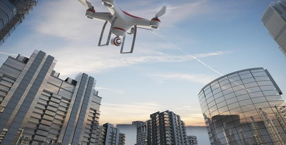
Lord' s Eye is a tool which helps users to safeguard themselves from any kind of accidents and with the help of users develop a safer and secure environment for them. It provides a new journey towards Urban Development which not only includes just the infrastructure but also monitoring the health of the users like by keeping a check on the pollution levels in the zone, by providing a optimised route to user for their safe travel , by giving them essential details about the potholes present on road and hence giving stakeholders a opportunity to provide governance at a small scale rather than at large scale . This app enables commuter safety in all possible directions .
Link to Project "Demo"
Link to Final Project
Detailed Project Description
Emergency services & Municipal Corporation / Gov
- Provide data of unsafe zones
- Provide probability of a zone/area turning into unsafe
- Imposing challans to commuters not following traffic rules (hence preventing accidents &
- unsafe areas)
Motivation -
- Incentivising on capturing unsafe zones
- Compensation on challans for identifying unsafe zones & providing solutions / helping to
- solve the problem.
- Incentivising shop owners for using video feed whenever required for defining unsafe
- zones
Business Model -
- Recommendation of less unsafe user routes
- More/less premium based on unsafe zone
- Strategic location & facts to municipal & road maintenance team.
- White labeling
- Data insights to Target Audience
- Selling datasets & insights to Autonomous vehicle manufacturing companies
Tools -
- Android Studio
- Machine Learning
- Blockchain technology
- JavaScript
- Firebase cloud
- Web Scrapping
Space Agency Data
Nasa Space Apps Partner helps us in the getting the following details -
- The app captures driving data like speed, braking, etc
- Recognise driving habits and gives feedback on the behaviour
- Gives helpful tips for safer driving
- Incase of an accident, distress signal can be sent to the nearest emergency services
- like police station, hospitals, fire station, etc
- Image Processing can be used to detect the probability of the collision of car with the
- vehicle in front and can be alerted about the imminent collision.
We have used NASA Earth Observations, MODIS, Landsat and USGS Earthquake dataset.
We have used the Earth Observations Datasets from NASA Earth observations and Nasa GIBS.
For average land and sea surface temperature we use the MODIS Datasets.
For chlorophyll, NO2 and CO Datasets we use GIBS.
We have used the USGS earthquake data to create the earthquake visualiser where the user can query over a period and can arrange them according to magnitude or according to time.
For the Aerial labels we use the bing map data and for tectonic plates we use the tectonic plates layers.
Hackathon Journey
The Hackathon Journey was amazing and it provided me immense pleasure for big part of such a great Hackathon , as it has been organized by NASA .
How We Developed This Project
After seeing some sample sites provided by the Challenge resources, we realised we can build an upgraded version of these sites, keeping the overall view concise but informative and interactive at the same time. Basically we aimed at serving the huge data within your grip.
But first we needed to create the globe, so we used nasa worldwind for it.
Tech stack used:
->Python
->Javascript
->Flask
->HTML
->CSS
->Bootstrap
->jQuery templates
->requireJS
->plotlyJS
->Heroku
Then we use HTML and Javascript for making the frontend. At first for the globe we generate it using worldwind web.
For styling we use Bootstrap templates and CSS. We also used jQuery for seamless loading of the Worldwind globe. We use requireJS for some cdn functionalities.
For backend we choose python and flask microframework, as its easy to create and powerful at the same time.
Then we deploy our project with the help of heroku. We create an automatic deploy or CI/CD (Continuous Integration and Continuous Delivery) for our master branch. Which means whatever changes we push to the master branch get deployed in the site hassle free.
The problems which we faced are making the website interactive for every users and breaking down the data to small sections along with the entire data to be served at the same site.
We have solved this problem to certain extent. The only thing left for us to do is to add more data and some query parameters.
References
For Datasets and Resources:
1) NEO: https://neo.sci.gsfc.nasa.gov/
https://earthdata.nasa.gov/collaborate/open-data-services-and-software/api
https://search.earthdata.nasa.gov/search
https://cdn.earthdata.nasa.gov/eui/latest/docs/
https://neo.sci.gsfc.nasa.gov/wms/wms?SERVICE=WMS&REQUEST=GetCapabilities&VERSION=1.3.0
2) USGS: https://en.wikipedia.org/wiki/United_States_Geological_Survey
https://earthquake.usgs.gov/earthquakes/map/?extent=14.26438,-125.94727&extent=56.51102,-64.07227 (this is a sample extent shown here)
https://earthquake.usgs.gov/earthquakes/feed/v1.0/geojson.php
3) MODIS: https://en.wikipedia.org/wiki/Moderate_Resolution_Imaging_Spectroradiometer
https://lpdaac.usgs.gov/products/mod11a1v006/
http://dx.doi.org/10.5067/TERRA/MODIS_OC.2014.0
http://dx.doi.org/10.5067/TERRA/MODIS_OC.2014.0
https://earthexplorer.usgs.gov/inventory/documentation/json-api
5) WorldWind Web:https://en.wikipedia.org/wiki/NASA_WorldWind
https://link.springer.com/article/10.1186/s40965-017-0016-5
For techstacks we used:
1) python: https://www.python.org/doc/
2) Boostrap: https://getbootstrap.com/docs/4.5/getting-started/introduction/
3) jQuery: https://api.jquery.com/
4) heroku: https://devcenter.heroku.com/categories/python-support
Tags
#lordsEye #spaceappstwentyone #oneappforyou
Global Judging
This project has been submitted for consideration during the Judging process.