
High-Level Project Summary
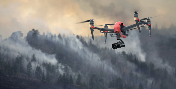
We created a consept of interactive map that can be used to manage citys services and resources more efficiently. It uses satelite and drone images from a city and machine vision picksup different probles in the city. For example if there are thrash on the streets, is there unploved streets or drought. The drones fly automatically and photograph predefined routes. This realtime monitoring helps the city to use its resources more efficiently and create safer and cleaner place to live.
Link to Project "Demo"
Link to Final Project
Detailed Project Description
This consept relies heavily on machine vision and machine learning. The images that the drone take will be analyzed by a machine vision and compared to previous images and satellite imagery. This data is then compiled to a map that the citys operating personnel can use to inform themself with the collected data. The hardest part is the software development and integration of different technologies. The drones and machine vision already sufficient enought to make this kind of a project only challenge is to get investment and customers.
Space Agency Data
Nasa coillision avoidance programn and landsat 8 imagery was used.
Hackathon Journey
The journey was interesting and provoked ideas and consepts. This was a very nice exprience.
References
Yandex imagery of moscow was used. https://yandex.eu/maps/213/moscow/?ll=37.622504%2C55.753215&z=10
https://www.dji.com/fi/matrice600-pro/info
https://www.nasa.gov/feature/collision-avoidance-technologies
https://www.qualcomm.com/products/qualcomm-flight-robotics-rb5-5g-platform
Tags
#citymaintanance
Global Judging
This project has been submitted for consideration during the Judging process.