
High-Level Project Summary
ProTech Solutions has identified the different problems in urban development areas and possible solutions. We realised that urban cities are facing severe pollution, increased crime rates ,depression caused by the heavy migration of people from rural areas to urban areas. We have developed an app that works with drones and satellites to collect huge amounts of data in all of these areas in order raise awareness, and also help NGOs or government organizations that need this data for precise and immediate action. This solution prevents ignorance and reduces the risk of problems becoming too large to handle.
Link to Project "Demo"
Link to Final Project
Detailed Project Description
The Project's Goal is to raise awareness of the citizens in urban areas to induce active participation in making their cities greener, safer and healthier for everyone. At the same time provide precise and accurate information that will help NGOs or Governmental Organisations reducing the risk of devastating consequences of problems that have been neglected for too long.
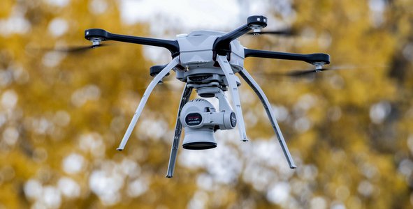
Our Project does this through the power of Data. Using Satellite guided drones we will create a database that records different types of data collected, such as different concentrations of different of pollution in different areas or varying crime rates in particular areas in a city. These databases will be the sorted, organised and used in combination with Satellite Imagery to create different kinds of images holding different information, for example: satellite maps showing different areas with intense water, air or land pollution.
This project will be especially useful for developing countries in Africa or overpopulated countries like India to find control and maintain the living conditions for the better.
For the backend coding we found it best to use Python and Jupyter as it is best suited for holding and working with big data sets. This can then be coupled with machine learning and AI in drones for recognising and processing different things. For example recognising whether water is sanitary or not.
Space Agency Data
We used almost all our ressources to finalise our project. It was very interesting to have real life satellites images and datas to really understand the uses and the limites faced while using those informations.
https://worldview.earthdata.nasa.gov
https://gportal.jaxa.jp/gpr/?lang=en
Having access to this specific interactive platform was more than a bonus in the realization and the conception of our whole project.
Understanding how drones, satellites and radio waves works all together was not that easy but we finally made something coherent and credible.
Hackathon Journey
Space App Challenge is a once-in-a-lifetime experience. Given the fact that all members have a particular interest in the data collected by satellites it was easy for us to develop our idea and the adaptation between members was done very quickly. We learned a lot especially the teamwork, the grouping of ideas and especially the team spirit.In order to overcome the difficulties we have encountered in the realization of our project we have always kept in mind that it can be evolutionary and deserves to be explored. We would like to thank Frank Mbouga in particular for the organization of the first Hackathon in Kaiserslautern without forgetting Professor Dieter Rombach and his motivating speech on the dream during difficulties.
References
https://earthdata.nasa.gov/earth-observation-data/near-real-time/hazards-and-disasters/air-quality
https://giovanni.gsfc.nasa.gov/giovanni/
https://eo-toolkit-guo-un-habitat.opendata.arcgis.com
https://sedac.ciesin.columbia.edu/mapping/popgrid/
https://earthdata.nasa.gov/earth-observation-data/near-real-time/hazards-and-disasters/air-quality
https://eo4sdg.org/wp-content/uploads/2021/01/EO_Compendium-for-SDGs-compressed.pdf
https://unstats.un.org/sdgs/metadata/?Text=&Goal=11&Target=
Tags
#drones#satellites#app#sustainable#life#air#hapiness#hope
Global Judging
This project has been submitted for consideration during the Judging process.