
High-Level Project Summary
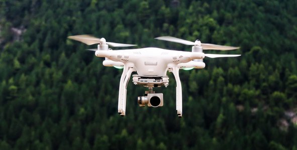
The UAV (Unmanned Ariel Vehicle) technology becoming one of the emerging technologies used in many sectors. On the development of multirotor drone specialized for disaster management, with appropriate specifications. During a disaster, the building blocks of disaster management are disaster risk reduction, preparedness, response, recovery, relief, and rehabilitation. By using drones during disasters we can led surveillance helps with a quick anomaly or change detection. These drones can alter their flight path mid-air to investigate a suspicious occurrence. Drones reduce the overall disaster response time by (up to) 44.46%. This time helps reduce the extent of a potential disaster.
Link to Project "Demo"
Link to Final Project
Detailed Project Description
The project is to develop a multirotor drone (UAV) operated autonomously. By using this multirotor we can boost disaster response, search and rescue. This multirotor has a specification of high-quality vision camera, night vision camera, GPS module, High payload carrying capacity, and long-range capability. This drone can quickly conduct a high-resolution visual/thermal survey – beamed back live to the ground team. The firefighters would know exactly how to plan their actions to properly utilize their resources (water, equipment, personnel, etc.) and get the desired result.This drones conduct high-res visual and thermal imaging to give a clear picture of survivors, even under rubble or within inaccessible crevices. The drones cover multiple acres quickly giving a detailed outlook of the terrain. This helps the on-ground team understand all access points and path towards the survivors. It also helps them understand the current situation in terms of communication or transport disruption.
Space Agency Data
In this project, we have used the Nasa science Earth data particularly, cyclone data and weather forecast data to predict the disaster.
And we have also used the data of Earth Observations Toolkit for Sustainable Cities and Human Settlements, particulars of Global Human Settlement-Functional Urban Areas to predict the risk factor during disaster situations.
Hackathon Journey
This space Apps Challenge contest really gives a woeful experience, I have learned how to overcome a challenge or problem with innovation or ideas. The UAVs are the ones that really inspired me and my team to take this challenge.
References
In this project, for the development of UAV, we have used NASA science data for this project and other tools are 3D mapping softwareDroneDeploy 3D mapping mobile app. Pix4D Mapper photogrammetry. DroneDeploy Enterprise 3D Map. Autodesk ReCap photogrammetry. SimActive Correlator3D™ software.
Tags
#disaster,#monitoring,#urban,#UAV
Global Judging
This project has been submitted for consideration during the Judging process.