
High-Level Project Summary
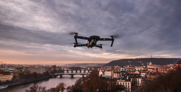
One of the most significant concerns about the future is how human actions have been impacting the environment and boosting climate changes all around the world, especially in urban areas. This problematic scenario points out the urgent need of more sustainable, inclusive and resilient plans that may allow local stakeholders, the government and the own population to participate actively in the development and maintenance of the urban space. Because of that, we came up with our solution: an app equipped with an AI that uses satellites and UAVs data to identify and suggest the best spots and seeds for planting across the city based on the user’s geolocation.
Link to Project "Demo"
Link to Final Project
Detailed Project Description


Disponível também em: https://www.figma.com/file/gpHzunBsjlOvSU5XeY6xXt/Hackaton-NASA-Public?node-id=13%3A387
Space Agency Data
Our team came up with the idea of using AI really early. We're aware that the proper use of AI requires a lot of data, and we knew that NASA had a lot to offer. However, that huge load of data, while important, isn't human readable. With that in mind, what we were looking for was something with a graphical interface that could show us statistics about that data directly, preferably on a map. To our delight, NASA's EOSDIS Worldview is exactly what we were looking for.
This website has numerous sets of Near Real-Time Data (NRT), called "Layers", which can be used on top of each other. We looked at many of these layers and their combinations, but one that's particularly interesting is the "MODIS/Terra Near Real Time (NRT) Vegetation Indices Daily Rolling-8-Day L3 Global 250m SIN Grid", which made our team notice that, despite our country's large pool of natural resources, the major cities are always coloured the same way as deserts are, showing minimal signs of vegetation, which gives some indication as to how the world also looks like through these lenses.
Although this specific data set isn't enough to bring our project to production standards, it was highly important to define our scope, and we know that some of the other layers on EOSDIS Worldview used in conjunction are more than enough to make the project come to fruition.
Hackathon Journey
A fact: the hackathon isn’t resumed by thinking about a challenge and possible solutions. It goes much further, because, above all, it’s an experience in which we can connect with real problems of our world as well as with people who are just as bothered by them as us.
Especially talking about our team, we can definitely say that not only we learned a lot during this event, but we had a lot - I mean, really a lot - of fun too! In fact, we chose the challenge of drones and satellites for urban development because it has in its essence something we are all connected by: tech.
As students of IT, we know very well about the potential and significance that treated data collected from drones and satellites has to the modern world. So, the thought of using all of this disaggregated information to turn it into knowledge that aids citizens, governments and local stakeholders to help in urban development excited us a lot.
Shout out to the best mentors in the whole galaxy: Isabel Sartori and Larissa Scarano! Without your help, a huge part of our work wouldn’t be possible! Thanks, girls! We are only five, but with you guys, we are, in fact, team SETE.
References
https://worldview.earthdata.nasa.gov/
https://www.fs.usda.gov/managing-land/urban-forests
https://www.intechopen.com/chapters/61524
http://www.aretasaerial.com/products/uav-drone-temperature-relative-humidity-monitoring
https://vitruvius.com.br/revistas/read/arquitextos/12.133/3941.TCC
https://brasil.un.org/pt-br/sdgs
Urban green spaces and health. Copenhagen: WHO Regional Office for Europe, 2016
https://www.bbc.com/portuguese/internacional-57672256
Tags
#drones #trees #satellites #sustainability #app
Global Judging
This project has been submitted for consideration during the Judging process.