Awards & Nominations
Landslide Detection Squad has received the following awards and nominations. Way to go!
 Local Impact

The solution that demonstrates the greatest potential for local impact.

Landslide Detection Squad has received the following awards and nominations. Way to go!
The solution that demonstrates the greatest potential for local impact.
Early warning of landslide events is critical to inform at-risk communities and emergency response. On forested slopes, tilting of trees and change in canopy structure can indicate soil and rock movement is occurring, which is a precursor to landslide events. Taking advantage of new sensors providing high-resolution images and deep learning technologies for tree detection, we propose and prototype a method that detects a canopy movement on slopes that’s indicative of landslide risk. This information is used to enhance landslide risk models and is embedded within a system that generates dynamic risk maps, publishes alerts when situations are critical, and supports government agencies to plan
Between 1998-2017, landslides affected an estimated 4.8 million people with over 18,000 fatalities. Climate change, deforestation, and other land cover changes are intensifying landslide risk. Landslide impacts can be extensive, including loss of life, destruction of infrastructure, damage to land, and loss of natural resources. Landslide material can also block rivers and increase the risk of floods. This has a devastating effect on farmers’ livelihoods as it can block access to land for years, destroy seed and food stocks, and results in the loss of livestock and standing crops.
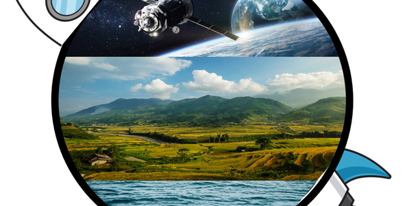
Landslides often occur in remote regions of complex terrain and steep slopes which makes in-situ early warning monitoring and emergency response challenging. Satellite observations provide a means to remotely monitor for landslide risk in inaccessible locations, especially when combined with data (historical events, pictures, etc.) provided by the community via apps or website platforms. In fully or partially forested slopes, common in many landslide risk regions, movement of soil and rocks is indicative of risk of planar or rotational landslides and soil creep. This movement can be hard to detect in satellite images or is obscured by tree canopy. Field observations have shown that visually apparent tilting of trees and canopy movement is a precursor to slope movement and landslide risk.
Advances in sensors (e.g. cubesats and UAVs) and AI and deep learning technologies have increased capacity to detect and monitor trees. We leverage these advances extending the DeepForests tree detection Python algorithm to detect trees in RGB satellite or aerial images, detect tree movement between successive image captures, and relate tree movement to landslide risk. The DeepForests algorithm is a convolutional neural network model built using pytorch. Future work will develop fine-tune the DeepForests model to be optimised for landslide-prone terrain, development of post-processing routines to characterise tree geometries ensuring the same tree can be tracked across successive images, algorithms to distinguish drift in tree movement from sensor noise, and algorithms to relate tree movement to landslide risk.
A prototype FastAPI app has been developed (https://github.com/rociopey/landslidedetectionsquad/tree/main/server)that accepts a georeferenced RGB image (e.g. as captured by a satellite or aerial sensor) and returns geometries of tree extents within the image. This FastAPI app will be extended to provide a comprehensive landslide risk monitoring system that can interoperate with emergency management and government systems and receive input information from affected communities. The FastAPI app will subscribe to satellite image providers updating risk maps as new images are captured, provide an API for users to upload custom images (e.g. from UAVs) to generate custom risk maps, and will publish the risk map as a web map service and spatial data layer.
The output of this project is a platform hosting a risk map, which will identify the areas that need more attention and generates alerts when situations are critical. This map will include the evacuation centres and routes to reach them in the safest way possible, and can be used by government agencies to plan ahead for emergency situations.
In order to identify the areas where our model would be applicable, we had to apply a few constraints over the areas already identified as prone to landslide risk. In the first step, we used the Global landslide susceptibility map (NASA) to see the major areas that required attention. Later, we narrowed down these areas considering the following parameters:
-The areas need to be forested: we used a land cover layer, developed using Sentinel-2 imagery;
-Had steep slopes: a DEM by JAXA ;
-And were located in areas where the geology types and structures would influence the occurrence of landslides: World geologic maps by USGS.
Our team is concerned about how natural hazards have negative effects on people’s lives; this is why we are presenting a solution that will allow for early detection of landslides. Our approach to develop this project was to do a brainstorming session, where everyone contributed with ideas, until we came up with the final one. It is great to have people with different backgrounds and skillsets in the team, as it allows us to solve the issues we faced more easily. In conclusion, our Space Apps experience was excellent, because collaboration leads to better solutions.
We would like to thank the organizers for checking up if we needed help and providing lunch during the weekend, and Venture for providing the space to work and WiFi access (thanks Felix!).
Space agencies data
JAXA:
USGS:
-Geology: country level (shp) or global(WMS)
SENTINEL:
NASA:
-Global landslide susceptibility map
-Landslide reporting tool: future work should address how to incorporate data collected using this tool to the model, in order to enhance the results.
Scripts
-Python Package for Tree Crown Detection in Airborne RGB imagery, https://deepforest.readthedocs.io/en/latest/landing.html#
Bibliography
-Karel Šilhán, 2021. Dendrogeomorphology of Different Landslide Types: A Review
#landslide #forests #EO #trees
This project has been submitted for consideration during the Judging process.