
High-Level Project Summary
We deploy an innovative AI-based landslide detector that links global landslide inventory with local-scale landslide monitoring. This application integrates the automated detection model into an interactive, user-friendly and lightweight framework that does not require any knowledge and professional background in remote sensing and computing. It can facilitate knowledge sharing among all stakeholders and engage people from both science and community to collaborate in evaluating the risks of landslides in rural areas. This application has great potential to be further developed with NASA Landslide Nowcast platform.
Link to Project "Demo"
Link to Final Project
Detailed Project Description
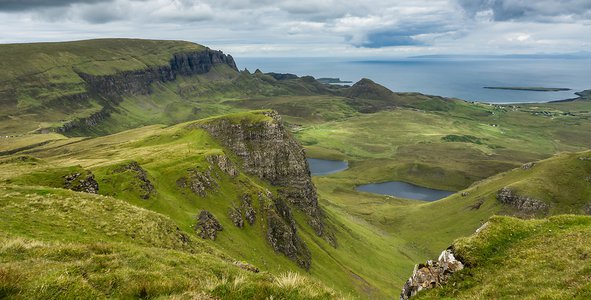
Landslide detection can be a time-consuming and labor-intensive task that usually involves several parties: surveyors, geoscientists, local communities and government officials. As landslides can be a major problem, it is desirable to have an automatic prediction system to detect landslides quickly to avoid loss of life. How can we speed up the process between landslide detection and community response? Creating a better knowledge sharing and communicating system is our way of approaching this problem.
We use the innovative tools of Google Earth Engine platform for acquiring various remote sensing images, kepler.gl for large-scale geospatial data analysis and visualization, and convolutional neural network for advanced image processing and change detection.
Our application automates the whole process from locating global landslide events, acquiring remote sensing imagery, pre-processing images and making predictions with a deep learning model. We simplify the process and integrate all steps in a Jupyter Notebook with minimal user intervention. We provide a fun-to-use, interactive map based on open-source geospatial analytical tool kepler.gl, where users can explore global landslide inventory data. Once users select a region of interest on the map, they only need to enter two date ranges for both the pre-event and post-event to the pre-trained AI model to make detection.
We delivered a Python-based open-source library landslide_sentry that provides an automated landslide detection pipeline using satellite data with minimum user interaction. This detection pipeline consists of four main steps: data acquisition, data pre-processing, neural network inference and result presentation.
Data acquiring is implemented in landslide_sentry.tiff_downloader, using Google Earth Engine API as the backend. Traditionally, satellite data is manually selected by humans, and has to be ordered and downloaded from official data platforms, which is very time-consuming and requires specialised knowledge in geology. Our data downloader simplifies this step by only asking user for input of a location (latitude and longitude) and time ranges and will automatically seek for the best data (least cloud coverage) in the user specified ranges. For our detection routine, the required satellite data are from Sentinel-2 1C and 2A data products and Global Digital Surface Model (AW3D30) product.
Data pre-processing is handled by landslide_sentry.tiff_utils, which uses GDAL methods as the backend. The key operations include numeric type conversion and cloud mask unification.
We utilise a pre-trained convolutional neural network resulted from the work of Prakash N et al. The model was designed using TensorFlow framework which is portable on both CPU and GPU systems. The model inference is implemented in landslide_sentry.landslide_mapping and cnn_landslide_mapping.predictor.
We chose Jupiter Notebook for result presentation, to allow rapid development and high portability. We created a notebook hosted on Google Collab to simplify the process of setting up the Python environment and to avoid hardware and software incompatibilities. In this notebook, we included an interactive landslide inventory map using the keplergl framework and NASA Global Landslide Catalog data. The aim of this map is to provide a fun-to-use and interactive database helping the users to navigate to the time and location of documented landslides.
Space Agency Data
Initially, we got inspired by the NASA Global Landslide Nowcast model (although we didn't use it at last) and started to think about how to make quick and accurate local landslide detection if we got a nowcast. For our product, we use Cooperative Open Online Landslide Repository (COOLR) Sources and Citations from NASA Global Landslide Catalog Downloadable Products Gallery as the global landslide data pool.
For the main infrastructure of landslide detection, we use 10-m resolution bands of Sentinel-2 Level 1C and Level 2A products, and topographic information of the Earth's surface from the Global Digital Surface Model (AW3D30) product.
Hackathon Journey
This is my first hackathon ever and I feel very encouraged by this journey. I accepted this challenge, took the initiative to form a team, do the research and draft a plan only two days in advance. I have tried many new things in life, like script compilation and adapting the convolutional neural network (CNN) model for our own work. It is a thrilling and exciting way to learn, to gain and to share.
Being a researcher in environmental science for seven years, I gradually understood how important it is to engage different parties in a collaboration for solving environmental issues, but also how challenging this process could be. We sometimes spend months or even years collecting data and then even longer time documenting and publishing the gained insights. Responding to an emergent situation like a natural hazard, how can we speed up this information-sharing process and provide professional evaluation without delay? Transferable knowledge that can be understood by the public and tools that can be shared among stakeholders are vital. By taking on this challenge, I simulated the collaborative, time-critical working environment with people from different backgrounds and practised transferring our skills and knowledge for solving this problem together.
Our strategy for addressing this challenge is to adapt the most innovative methods, building a smooth and reproducible workflow that can be further applied to other topics in related areas. We have all been surrounded by news about how artificial intelligence helps improve the prediction of complex systems. But how hard would it be for people without a computing background to understand them and use them? By doing research on the recent improvement in landslide detection, we find a paper published in Nature utilizing deep learning models in landslide detection. It is the most difficult part for me, and it takes the most time in adapting these methods in our application. Besides, I mostly contribute in producing a seamless workflow to filter and download data for detection. I am feeling satisfied with this work because it minimizes the torture of gathering data, speeds up the processing and leads us to the juicy part of research.
I would like to thank my teammate Chengyu. We complement each other greatly with our own expertises in computing (from him) and in geospatial data analytic (from me). We communicate constantly to help each other in understanding data and codes. We are both very enthusiastic and dedicated working on this project. I have learnt a lot from him. Also I would like to thank my supervisor team and my boss from internship. Because of their encouragement and introduction, I find this amazing world of space data and I gain the new perspective of observing the world.
References
Publication:
- Prakash, N., Manconi, A. and Loew, S., 2021. A new strategy to map landslides with a generalized convolutional neural network. Scientific Reports, 11(1).
Tools and data:
- https://research.google.com/colaboratory/
- https://maps.nccs.nasa.gov/arcgis/apps/MapAndAppGallery/index.html?appid=574f26408683485799d02e857e5d9521
- Geologic Hazard Maps | WA - DNR
- https://reliefweb.int/sites/reliefweb.int/files/resources/UNOSAT_A3_Mocoa_Colombia_MudFlow_04April2017.pdf
- https://github.com/ChenyuZhang16/landslide-mapping-with-cnn
- https://kepler.gl/
- https://www.mapbox.com/mapbox-studio
Tags
#AI #ScientificCommunication #landslide #changedetection
Global Judging
This project has been submitted for consideration during the Judging process.