Awards & Nominations
EAGLE AI has received the following awards and nominations. Way to go!
 Global Connection

The solution that best connects people around the world through technology.

EAGLE AI has received the following awards and nominations. Way to go!
The solution that best connects people around the world through technology.
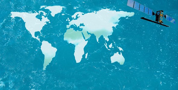
We've developed an AI-powered tracking system to autonomously detect, identify, quantify and follow ocean plastic with up to 100% accuracy.The most important added value in our solution is how dynamically it can follow and project the movements of ocean plastic which gives us a flexible ability to handle the situation.
Our solution has the ability to:
Flowchart illustrating Eagle AI solution stage

We've set up a protocol that allows us to go from "Data Collection; Studies, News..) to Data Processing (Atmospheric and Radiometric correction of satellite imagery, FDI, NDVI, spectral characterization of plastic…) to the quantification of plastic marine debris while using AI/ML to continuously enhance the performance of our solution and to precisely forecast the movement of plastic detected over time using ocean hydrodynamic and weathering models.
Performance demonstration of EAGLE AI solution for reference cases 
We used JavaScript within Google Earth engine to create an app with a data pipeline, allowing us to collect, manipulate and process satellite imagery.
Link Code: https://docs.google.com/document/d/1-kT0YT0ZadzfHO5wBJmIxG_J2TFQKwowcIJZa9Pw5jU/edit?usp=sharing
Snap of Eagle AI App

Landsat 8 Collection 1 Tier 1 and Real-Time data OLI Raw Scenes (NASA/USGS): We used it to collect data and feed it to our machine learning model in order to test and validate the accuracy of results.
Sentinel-2 MSI: MultiSpectral Instrument, Level-1C of European spacial agency (ESA): Used to process collected images and detect marine plastic while training our machine learning algorithm.
N.B: As a start we used 670 datapoints
Our journey in Space Apps is once in a lifetime experience as you get the chance to know more about the different challenges the world is facing and to know that more people are interested in solving them.
Unexpectedly, we learned that there is a strong willingness to solve the challenges the world is facing.
In a tangible way, we also got the chance to actually see how dangerous certain threats are to the environment.
We felt inspired to contribute to the growing relevance of using Artificial Intelligence and Machine Learning in addressing modern world problems.
We live in Morocco, which is an emergent country that progresses in different industries, which is the main reason why we continuously see a bad influence on the quality of our beaches, especially those on the Atlantic Ocean.
The impact now is clearly seen in Casablanca where we live right now, and this is how we got inspired.
The very first step in our approach was to gather all relevant information and data about "Plastic & Ocean" from various datasets and reliable sources in order to feed our machine learning model. To do this, we created a data pipeline that pulled satellite imagery from NASA’s worldview servers. The specific satellites we pulled from are NASA Landsat8 satellite and ESA. Sentinel2 satellite.
The second step in our approach was data processing (Atmospheric and Radiometric correction of satellite imagery, FDI…)
The third step was training, measuring accuracy, testing, and validating results.
The last step in our approach was to study all factors and triggers responsible for the movements of plastic debris to forecast the path of plastic debris.
Biermann, L.; Clewley, D.; Martinez-Vicente, V.; Topouzelis, K. Finding Plastic Patches in Coastal Waters using Optical Satellite Data. Sci. Rep. 2020, 10, 1–10. https://doi.org/10.1038/s41598-020-62298-z
Bidroha Basu ; Srikanta Sannigrahi ; Arunima Sarkar Basu and Francesco Pilla. Development of Novel Classification Algorithms for Detection of Floating Plastic Debris in CoastalWaterbodies Using Multispectral Sentinel-2 Remote Sensing Imagery. Remote sens. 2021, 13; 1598. https://doi.org/10.3390/rs13081598
Feng Yin1; Philip E Lewis1; Jose L Gomez-Dans; Qingling Wu. A SENSOR INVARIANT ATMOSPHERIC CORRECTION: SENTINEL-2/MSI ANDLANDSAT 8/OLI1, 2019. https://doi.org/10.31223/osf.io/ps957
The AlfredWegner Institute (AWI) LITTERBASE portal https://litterbase.awi.de/litter
Mehrdad Moshtaghi; Els Knaeps; Sindy Sterckx; Shungudzemwoyo Garaba; Dieter Meire. Spectral reflectance of marine macroplastics in the VNIR and SWIR measured in a controlled environment. Sci. Rep. 2021. 11:5436. https://doi.org/10.1038/s41598-021-84867-6
#SpaceApps #Marine_debris #Clean_ocens #Plastic #Satellites #AI #ML #Monitoring
This project has been submitted for consideration during the Judging process.