
High-Level Project Summary
Aegir is a platform that brings the best of technology to structure available ocean debris data and empower regulatory authorities and communities with information that can help in cleaning and volunteering activities. Aegir has multiple blocks - 1. Time series analysis of satellite data that predicts and shows ocean plastic debris which helps users identity plausible trajectory and location of debris patches2. UAVs are fitted with edge computing to accelerate neural networks that help localise and classify the density of debris. 3. An application designed for citizen scientists, authorities and volunteers to help them plan community events and missions to clean up debris!
Link to Project "Demo"
Link to Final Project
Detailed Project Description
Aegir tightly integrates several modules together -
Analysing satellite data with Time Series Analysis
We began by using data sourced from NOAA, that provided geolocations of debris along with other metadata such as type, weight, flux and so on. We were able to analyse the data and plot graphs accordingly.

We further found data from missions hosted by https://https://theoceancleanup.com, with which we built our visualisation of time series analysis.

Object detection and Density Estimation using YOLOX and EfficientNet
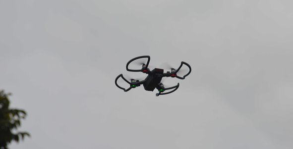
Our next module identifies and classifies ocean, river and waterbody debris by using high resolution aerial footage from UAVs or drones. We utilised YOLOX anchor-less object detection for this task and used EfficientNet as a regression model to generate density information and showcased it using heatmaps.

We served the models on our gunicorn/flask server so that it can be used by drones, community applications etc

 Here you can see an example of running live detections in our makeshift setup.
We managed to quantise and run the models using TensorRT on NVIDIA Jetson!
Community participation
We've seen various community efforts being organised in order to clean our oceans and other water bodies. We planned on automating this using Twitter. When the debris would be sufficiently close to coastal regions, our system would automatically shoot our tweets to initiate community events that would help with our fight against pollution!
Being a part of the community, users can use our platform to report debris accumulation.

Space Agency Data
To train our AI models for drone surveillance as well as Time-Series, we gathered data from the following resources.
NOAA - Satellite data for Ocean currents, surface temperature, e.t.c
ArcGIS - For Marine debris related data like Flux, size, type, e.t.c
The Ocean Cleanup - For aerial data of trash in the ocean.
HAIDA - For aerial data of trash scattered around in coastal regions and beach.
Hackathon Journey
We started by going through all the challenges and seeing which one we can connect to the most. After a good amount of research and brainstorming, we ended up with “Leveraging AI/ML for plastic marine debris”, dividing the project into three major parts which are,
- Debris Movement Prediction using Time-Series.
- Drone Surveillance for debris density and classification.
- Application to visualise the data and post-community-driven event alerts.
For developing the AI models from Time-Series and Drone Surveillance, we started looking at different sources starting with NASA Open Earth Data, The Ocean Cleanup Data, HAIDA Dataset e.t.c.
Once we gathered and cleaned up the required data, we started labelling and preprocessing data for training our models, which was finished by day 1 at midnight. Our deep learning model for drone surveillance is accelerated with TensorRT and deployed on the Nvidia Jetson Platform.
With our models ready, we moved ahead on day 2 by creating an Application to visualise our data and provide an easy-to-use platform for citizen-scientists to put their video/images and see the results and share the same on social media.
References
Literature Review
- https://www.nasa.gov/feature/esnt2021/scientists-use-nasa-satellite-data-to-track-ocean-microplastics-from-space/
- https://coast.noaa.gov/states/fast-facts/marine-debris.html
- https://www.iucn.org/resources/issues-briefs/marine-plastics
- https://oceanservice.noaa.gov/hazards/marinedebris/plastics-in-the-ocean.html
Data sources
- https://theoceancleanup.com/
- https://cscloud-ec2020.opendata.arcgis.com/datasets/data-marine-debris-monitoring-and-assessment-project-mdmap-accumulation-report-plastic-pollution/explore
- Y. H. Liao and J. G. Juang, "Application of Unmanned Aerial Vehicles for Marine Trash Detection and Real-Time Monitoring System," Master Thesis, Department of Communications, Navigation and Control Engineering, NTOU, ROC, 2021.
AI models
- https://github.com/Megvii-BaseDetection/YOLOX
- https://github.com/OniroAI/MonoDepth-PyTorch
- https://github.com/lukemelas/EfficientNet-PyTorch
Tags
#oceandebris #artificialintelligence #deeplearning #computervision #drones
Global Judging
This project has been submitted for consideration during the Judging process.