
High-Level Project Summary
Plastic Marine Debris is a problematic issue for both human and fauna in the water body as it hinders the free access to the clean water.We started with the scope to detect plastic first visually and then develop ML model in parallel to detect it automatically.In the beginning, we were not sure about the data and most focus was on the data selection and analysis.We came across many sources with prominent ones Sentinel 2, CYGNSS, and NOAA but we found Sentinel 2 can solve the problem of plastic location as it used reflectance measurement in different spectral bands with visible and infrared and short infra red, it can see what eyes can’t see.Data Analysis took most of the time.
Link to Project "Demo"
Link to Final Project
Detailed Project Description
Approach was to take data from multiple sources (Like Sentinel 2, CYGNSS, NOAA) and fuse them together to make better prediction and detection.
Detect plastic debris using ML models (pixel based – Naïve Bayes, area segmentation based using Mask R CNN)
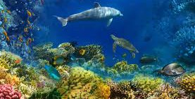
Detect Fauna (using both the model combination)
Track plastic debris area by using ML over a period
Track fauna area over a period
Showing the result to a web-based dashboard
Population trends on the bar chart
Plastic growth trends on bar chart
Detected plastic visualization on world map for each time period (each month or tunable time)
We used python and google colab notebooks for the experimentation and development with various libraries described in the references section below.
Space Agency Data
European Space Agency (https://sentinel.esa.int/web/sentinel/missions/sentinel-2)
Sentinel 2 L1C data was used.
We used it to get satellite images of sea area near Tampa Florida, USA for more than 1.5 years. We were inspired by the details this data has - location, visible bands, infra red bands which helped see things which eyes can't see in visible spectrum.
It helped in creating features which are not possible with optical imaging.
Hackathon Journey
Our space app experience was full of excitement and challenges. We found it to be very interesting in the sense we were working with the real data to solve real problems. It introduced us to remote sensing (totally new field) in a good depth. Our team wanted to work on some ML project which involves images and we found that this project fits our needs. But as soon as we started we realized that it is quite challenging even to find data and then do analysis of it. There were different approaches for data usage - some people were using wind speed and satellite data in conjunction to detect plastic debris which was quite interesting and complex. After lots of playing with different tools, data browsers we came to conclusion to use sentinel 2 data.
References
Dataset used: Sentinel 2 L1C
Hardware used: Google Colab Notebooks
Software used: Python (Jupyter, EO Learn, rasterio, geopandas, sentinelhub apis), Sentinel hub web browser, apache superset
Tags
#MarineDebris, #Sentinel2, #PlasticDetection, #PlasticDebrisDetection, #DebrisDetection, #RemoteSensing, #NasaSpaceAppChallenge, #NasaSpaceAppChallenge2021
Global Judging
This project has been submitted for consideration during the Judging process.