
High-Level Project Summary
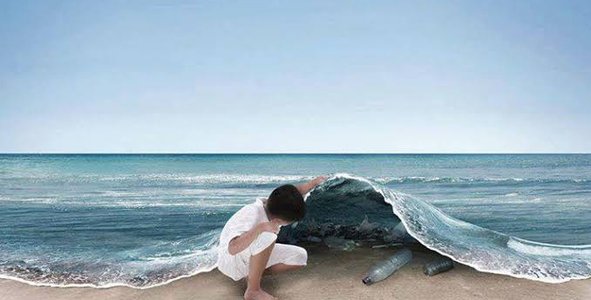
Where are the plastic waste in the oceans? How can all kind of persons find it rapidly and effectively? We proposed a methodology that allows finding and monitoring marine debris through neural networks and multispectral images. The identification of debris using the spectral signature in satellite marine imagery, in combination with the use of deep learning techniques, provides a way to identify marine pollution taking advantage of geospatial technology and the capabilities of convolutional neural networks because preserve the spatiality of the images, thus fulfilling the objectives of the proposed challenge.
Link to Project "Demo"
Link to Final Project
Detailed Project Description
Currently, people such as politicians or environmentalists need to know the location of marine debris in order to apply pollution containment measures or to carry out several enviroment cleaning. Due this, it is important to have a tool that can facilitate the identification and monitoring of these debris and their visualization in an easy and simple way.
Various traditional machine learning (ML) models have been used for the detection, monitoring and prediction of marine debris using multispectral images obtained by satellites. However, there are still some limitations with respect to these traditional models. Deep learning models such as neural networks can guarantee greater precision due to their ability to not lose spatial information. In the same way, we know that another problem is the quantity and quality of the images to be analyzed, so we believe it is important to focus not only on one source of information, but on the combination of several that have availability to access data in a free way.
The proposed process for this challenge is show is Figure 1. The process will begin by collecting multispectral images from several sources (Sentinel, Landsat) every 15 days and focused on coastal areas of the oceans. With these images, a preprocessing will be carried out to identify spectral signatures through the identification of RGB and FDI bands identifying regions of interest and patterns. With the collection of multiple patterns, a multilayer perceptron-type neural network will be trained. The obtaining of single band images, representing the Plastic Index - PI (Themistocleous et al. 2020) is also considered in order to train another artificial neural network architecture and eliminate false positives. With this step, a model can be created. Finally, this model will be used to do the prediction if the area has plastic debris or not.

Figure 1. Methodology proposed.
This information will be displayed in web app in a friendly way for all types of users. The tool will allow the search by zones or date, and will show the identification of the zones where the waste is probably located. The resulted image can be exported or saved as an image.

Figure 2. Website Prototype
We hope that this proposal can promote the search and identification of marine debris and raise awareness of the problem.
We use the following tools to prepare and develop the idea:
- GoDaddy (to create a dominio and a prototype of the website)
- Google Drive (to share documents)
- Jamboard (to do brainstorming)
- Among others.
The following tools will be used for the development the idea:
- TensorFlow.
- RasterIO
- OpenCV
- scikit-learn
- DataBase
- Google Cloud
As a future work, we want to show temporary images to monitor where the increase or decrease of the waste can be distinguished through the months. With the passage of time and having collected enough information, we will seek to train a new algorithm that allows predicting the behavior and possible route of the waste.
Space Agency Data
We will use data from Landsat satellites for our proposed process. The Landsat program is a enterprise for acquisition of satellite imager of Earth. Its images have been used in several research with promising results. The images will be obtained from https://earthexplorer.usgs.gov/, and will be pre-processed through the conversion of digital levels to physical parameters and atmospheric correction. Likewise, the fusion process will be carried out to give the spectral bands the resolution of the panchromatic band and have better results. Subsequently, spectral signatures will be taken through verified regions or points of interest.

Figure 3. Landsat image processing.
Hackathon Journey
This Space Apps Challenge was a unique experience for the whole team, as we were able to work with the data provided by the Space Apps page and to be able to identify almost immediately the problem we were facing. What inspires us as a team to choose this challenge was the desire to contribute to the preservation of the environment, and help in some way to reduce the indices of environmental pollution that are present in the sea.
Our approach is to provide a tool for people to take advantage of artificial intelligence to achieve our goal of identifying and monitoring marine debris. In this two days of works, we set schedules, tasks, and goals to accomplish. For example, we met at a specific time, shared ideas and knowledge, and according to that we went on deciding tasks according to the abilities of each team member.
Finally, we would like to thank the oceanographer Sara Purca, who is a Peruvian engineer who is fighting to save the sea, we thank her because her work and passion inspired us to want to contribute to this project.
References
1. Srikanta Sannigrahia, Bidroha Basu, Arunima Sarkar Basua, Francesco Pilla. “Detection of marine floating plastic using Sentinel-2 imagery and machine learning models.” School of Architecture Planning and Environmental Policy, University College Dublin, Ireland. (2021)
2. Winans, Willard Ross. “Automatic detection of Hawai'i's shoreline stranded mega-debris using deep learning-based object detection”. University of Hawai'i at Manoa. (2021)
3. Biermann, L., Clewley, D., Martinez-Vicente, V. et al. “Finding Plastic Patches in Coastal Waters using Optical Satellite Data”. Sci Rep 10, 5364. (2020) https://doi.org/10.1038/s41598-020-62298-z
4. Matias Alejandro Valdenegro Toro. “Deep Neural Network Debris Image Detection SONAR”. Heriot-Watt University, Edinburgh, Scotland. (2019)
5. Mattis Wolf, Katelijn van den Berg, Shungudzemwoyo P Garaba, Nina Gnann, Klaus Sattler, Frederic Stah, Oliver Zielinski. “Machine learning for aquatic plastic litter detection, classification and quantification (APLASTIC-Q)”. Environmental Research Letters 15 114042. (2020)
6. Odei Garcia-Garin, Toni Monleón-Getino, Pere López-Brosa, Asunción Borrell, Alex Aguilar, Ricardo Borja-Robalino, Luis Cardona, Morgana Vighi. “Automatic detection and quantification of floating marine macro-litter in aerial images: Introducing a novel deep learning approach connected to a web application in R”. Environmental Pollution. (2021) https://doi.org/10.1016/j.envpol.2021.116490.
7.Themistocleous, K., Papoutsa, C., Michaelides, S., & Hadjimitsis, D. "Investigating detection of floating plastic litter from space using sentinel-2 imagery". Remote Sensing, 12(16), 2648. (2020)
8.https://earthexplorer.usgs.gov/
Tags
#DeepLearning, #MarineDebris, #MultiSpectralImages
Global Judging
This project has been submitted for consideration during the Judging process.