
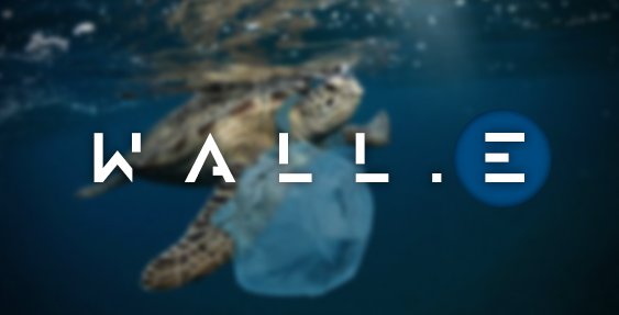
High-Level Project Summary
After a long search by team WALL.E, we found that satellites detect plastic marine debris, but with little accuracy and face problems to detect microplastic and Plastic deep underwater so we have created an autonomous submarine that can be the eye of satellites in the oceans to increase the accuracy of detecting plastic and also to identify more plastic and its locations and thus classify it, using AI\ML to develop the submarine's work algorithm, in addition to no. of sensors that help it. WALL.E is very important that will help humanity get rid of the largest amount of plastic, as it is open source will help scientists and others to know the places of plastic through a website we created.
Link to Project "Demo"
Link to Final Project
Detailed Project Description
We, in the WALL.E team, create a great approach to solve the challenge we have already chosen. As we learned from the detail of the challenge, we will use AI and ML algorithms to provide a method for marine debris detecting, tracking, quantifying, and classifying. After collecting that data from different sources, we will discuss later in this slide, we will visualize that data using a responsive map. Firstly, our project consists of three main phases:
HOW IT WORK:
1. DATA COLLECTION:
-We will use two sources for this phase for data collecting. The first source is the data of NASA satellites that already detect marine debris all over the seas. But for our approach, we will use an AUV or autonomous underwater vehicle,that enhancing the tracking process and leverage the accuracy of detecting. Note that our AUV is an appropriate choice better than a drone because it will give us close information
-This can happen with using different technologies integrated with each other by AI and ML algorithms such as Slam system or simultaneous localization and mapping system, computer vision using OpenCV, sensor fusion system with lidar, ultrasonic, and IR sensors, which helps us to detect, classify and quantify marine debris autonomously using python and AI, ML and DL algorithms which decreases the time of detecting mission comparing to the accuracy.
2. Mapping and visualizations:
- After the phase of data detection and collection, we will use GIS technology (Geographic information system) to build an online livestreaming and feeding map using data collected by our AUV and satellite. We will connect our AUV with our live data to ArcGis which enables us to visualize data and into a responsive map with all needed information such as plastic location, classification, depth…. etc.
-By using ArcGIS we can build a website application using the API of ArcGIS for JavaScript. This makes the journey of the user include opening our website to get them to the landing page where they can view some elements such as
.Map tab
This tab will redirect them to the web app to view our live map with all information needed. Just by clicking on any part of the map, the information of location, classification, depth... Etc. will be shown.
.Technologies used
.Members
And there is another tab linked to GitHub that shows our open-source data used.
Technologies used
1. Slam system: (Simultaneous localization and mapping) is a method used for autonomous vehicles that let us build a map and localize your vehicle in that map at the same time. SLAM algorithms allow the vehicle to map out unknown environments and path planning and obstacle avoidance.
2. Computer vision, OpenCV: OpenCV (Open Source Computer Vision Library) is an open-source computer vision and machine learning software library. OpenCV was built to provide a common infrastructure for computer vision applications and to accelerate the use of machine perception.
3. Sensors:
Lidar: is a method for determining ranges (variable distance) by targeting an object with a laser and measuring the time for the reflected light to return to the receiver.
IR: Infrared sensors can be used to detect the presence of organic waste. But the method of detecting organic waste by way of differences in the weight of organic waste with waste paper and plastic waste is less precise. ... Infrared sensors have been able to detect the presence of objects.
Benefits:
1. we use a soft robot model for our AUV, we will use soft robot materials including silicone elastomers, urethanes, hydrogels, braided fabrics to endure high-level depth stresses when diving in the ocean.
2. It increases the accuracy. If the accuracy of the satellites in identifying plastic is about 85%, it will increase to 90% because it uses the data from the satellites and adds to it.
3. it can dive to greater depths.
WHAT DO WE HOPE?
We hope that WALL.E can identify plastic with high accuracy and that in the future, with more of our innovations or the innovations of others, it will be able to identify all waste and work on solar energy to be able to move more freely.
CODING LANGUAGES:
1. JavaScript
2. python
3. node is
Space Agency Data

A simulation of sea-surface temperatures from the Geophysical Fluid Dynamics Laboratory.

Image captured by the VIIRS instrument on board the joint NASA/NOAA Suomi NPP satellite

Still from a video showing high levels of microplastic pollution (red)
Hackathon Journey
our experience
It was a very enjoyable experience and at the same time we felt some pressure, but in the end, our result was very satisfactory for us.
What did we learn
We learned teamwork despite its difficulty because it was online. We also read a lot about the rest of the challenges and got to know more information that we did not know anything about.
What inspired our team to choose this challenge
We did not know that the problem of plastic is this large and dangerous, and when we read about it, we all wanted to invent something that would rid marine creatures of the torment they suffer.
our approach to developing this project
We, in WALL.E team, create a great approach to solve the challenge we have already chosen. As we learned from the detail of the challenge, we will use AI and ML algorithms to provide a method for marine debris detecting, tracking, quantifying, and classifying. After collecting that data from different sources, and we will visualize that data using a responsive map.
team resolve setbacks and challenges
We faced many problems during the search to find, but we always resorted to the question and the expanding search for solutions, and we also went to ask specialists in the field of solutions.
References
1. https://www.jpss.noaa.gov/viirs.html
2. https://oceanservice.noaa.gov/facts/satellites-ocean.html
3. https://earthdata.nasa.gov/eosdis/science-system-description/eosdis-components/gibs
5. https://marinedebris.noaa.gov/discover-marine-debris/where-does-marine-debris-come
6. https://podaac.jpl.nasa.gov/CYGNSS?tab=mission-objectives§ions=about%2Bdata
7. https://www.frontiersin.org/articles/10.3389/fmars.2019.00447/full#h3
8. https://www.mathworks.com/discovery/slam.html
9. https://coast.noaa.gov/states/fast-facts/marine-debris.html
10. https://www.esri.com/en-us/what-is-gis/overview
11. https://en.m.wikipedia.org/wiki/Unmanned_underwater_vehicle
Tags
#AUV #Plastic #Earth Message #walle#AUV, #Plastic, #Earth, #ArtificialIntelligence, #MachineLearning, #Water, #Robotics
Global Judging
This project has been submitted for consideration during the Judging process.