Awards & Nominations
WasAApp has received the following awards and nominations. Way to go!
Global Nominee

WasAApp has received the following awards and nominations. Way to go!
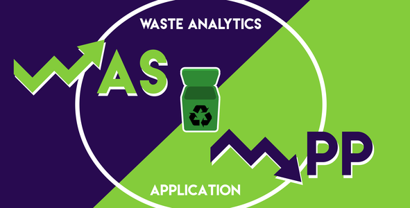
What’s up? WasAApp is here to share information on solid wastes present in Philippine water bodies. We provide the necessary data that identifies patches of solid wastes found in selected inland and coastal waters in the Philippines through satellite image analysis. Solid wastes greatly magnify the severity of natural disasters such as seasonal flooding and typhoons in which the country is most vulnerable. It is key for local water rehabilitation and disaster risk reduction programs to regularly assess the volume of solid wastes in Philippine waters. WasAApp therefore contributes towards proper mitigation measures for government end-users and empowering communities through information.

In 2009, Metro Manila and nearby provinces were severely hit by tropical storm Ketsana (local “Ondoy”). Within 24 hours, a total of 455 millimetres of rain were dumped causing the worst recorded flood event in Philippine history. Around 15,000 residents near the Marikina River were forced to evacuate as flood water engulfed the surrounding cities. The aftermath was as equally shocking as the debris and garbage left behind were piled two stories high in severely affected and low-elevated Marikina and Pasig City. Rehabilitation efforts were slow to commence as assessments of the damages require data from aerial shots, satellite images, and mapping of its extent. Solid waste and garbage have therefore increased the difficulty in rehabilitation efforts. This has prompted the necessity of stronger collaborative efforts from data science researchers in assisting the prevention and mitigation of solid wastes in inland waters and marine areas.
WasAApp is set to address the challenge under the category LEVERAGING AI/ML FOR PLASTIC MARINE DEBRIS. Under this challenge, it is identified that the Philippines consumes and discards millions of tons of plastics that end up in its coastal and inland waters. Around 0.28-0.75 million tons of plastic wastes per year enter Manila Bay alone. Whereas, other bodies of water such as rivers, lakes, and coastlines do not have readily available data on solid wastes and marine plastics present. This is in spite of the fact that over 60% of the population or around 70 million Filipinos live near bodies of water and are at the most vulnerable to flood hazards from typhoons and seasonal rains.

WasAApp Project tackles the challenge in a three-step approach.
First, it utilizes the flood hazard maps sourced from the Nationwide Operational Assessment of Hazards or Project NOAH in order to determine the flood-prone areas across the country. Next, bodies of water that are the direct cause of the flooding or are near areas where floods, as well as storm surges, occur are selected as areas of interest.
The second approach then utilizes optical and multispectral images of maps sourced from google earth and NASA worldview where data in the form of RGB and microwave spectral colors are gathered. Machine learning is then used to process the data that determines and classifies solid wastes present in the body of water.
The third approach invites the collaboration of local government units and communities in a crowdsourcing effort to gather pictures on-ground. This approach is able to pinpoint and confirm the presence of solid wastes as well as providing additional spatial data that supplements the satellite images.
With this, our solution is based on addressing the immediate need to mitigate the risks posed by flooding and storm surges by eliminating the additional hazards brought about by solid and marine plastic wastes.

Our solution is implemented in three ways. First, water development and rehabilitation authorities can use our data to supplement their river assessment programs and can help measure the effectiveness of their rehabilitation policies. Second, our data can help environmental solid waste management programs supplement information on where and how much solid wastes end up in bodies of water. Third, our data can be used by local disaster risk reduction offices (DRRMOs) for hazard prevention and disaster rehabilitation. This aids in initial aerial assessments of flooded or typhoon-affected areas prior to rehabilitation efforts which can help map out the volume of debris present.

There are two things that WasAApp wants to solve: detection of marine debris and quantity of this marine debris.
For the detection of the marine debris here is the simplified workflow of the process:

In quantifying the marine debris, this diagram below show the simplified workflow:

The Application Project works with 3 input data sets:
1. Local Data
2. Open Source Satellite Data
3. Crowd Source Data


Our project is a prototype towards developing strong collaborative efforts between downstream data analysis of satellite images and local government programs such as water rehabilitation, solid waste management, and disaster risk reduction. Our project’s impact is centered on reducing the risks posed by solid waste hazards in our country’s waters by identification, classification, and quantification using satellite data. We foresee that more than 50% of local government units which comprise all the coastal municipalities and cities across the country will be able to utilize our downstream satellite data for their assessments and disaster preparation programs once the WasAApp project is fully developed. Furthermore, through this project, the community and/or the developers will gain monetary funds through the recycling of the materials that will be gathered such as plastic bottles/containers.
Our team's future plan is to improve our application and have access to high-resolution data, hence provide better results. When that happens, we'll implement it in remote areas surrounded by bodies of water in our country, the Philippines, and other countries around the world. We strongly believe that thru the implementation of this project, we'll lessen the entry of solid waste or possible marine debris into the bodies of water, and that will help too in resolving marine environmental problems.
The Application will detect the 2-dimensional information from Sentinel 2A, Sentinel 2B, and Landsat 8. The area covered by the marine debris will then combine into a Digital Elevation Model (SRTM) to quantify how much volume of marine debris in a particular location
[1] Orbital Track & Overpass Time: https://worldview.earthdata.nasa.gov/
[2] Sentinel 2A
[3] Sentinel 2B
[4] LandSat 8
[5] SRTM
[6] Re-Analysis of past scenario: https://giovanni.gsfc.nasa.gov/giovanni/
Choosing one challenge from a wide variety of topics was a difficult choice. In the end, our team chose Leveraging AI/ML for plastic marine debris because we consider the presence of high pollution levels in oceans and waterways a serious threat to countries surrounded by bodies of water, such as Philippines. However, this is an issue that is unfamiliar to many Filipinos. Thus, we aim to create an effective and sustainable solution to address the presence of marine debris and raise awareness by making data accessible to more Filipinos.
Our team’s Space Apps experience is one full of discovery. This event was the first hackathon for many members. Nevertheless, it became a fulfilling event for everyone since the more experienced members always reached out and guided the other members in doing their tasks. The team learned more about the threats of marine debris and how remote sensing and satellite imagery can mitigate those threats. Through our research, we also learned of current initiatives of different countries to address this issue and how we can use our Space Apps output to amplify said initiatives.
Lastly, our team is very grateful to our local lead, Sir Mike, for all his guidance and organizing team formation sessions that ultimately helped us form this team. Best of luck to all the teams and we look forward to bringing our project to life!
Data Sources
Literature
#WasAApp, #AI&ML, #MarineDebris
This project has been submitted for consideration during the Judging process.