
High-Level Project Summary
MAPPING SPACE TRASH IN REAL-TIME Our Solution: We’ll try to map the space and trashes as obstacles, can avoid it by some the AI and Algorithms applied on the map technically to get the shot path but to can map, we could be to localize our orbit concerning Map and to create a map we must localize our orbit so it's an egg chicken problem by applying so we should apply the (SLAM) concept which is SLAM has been the subject of technical research for many years. But with vast improvements in computer processing speed and the availability of low-cost sensors such as cameras and laser range finders, SLAM is now used for practical applications in a growing number of fields.
Link to Project "Demo"
Link to Final Project
Detailed Project Description
We mapping the space and trashes as obstacles, can avoid it by some the AI and Algorithms applied on the map technically to get the shot path but to can map, we could be to localize our orbit concerning Map and to create a map we must localize our orbit so it's an egg chicken problem by applying so we should apply the (SLAM) concept which is
SLAM has been the subject of technical research for many years. But with vast improvements in computer processing speed and the availability of low-cost sensors such as cameras and laser range finders, SLAM is now used for practical applications in a growing number of fields
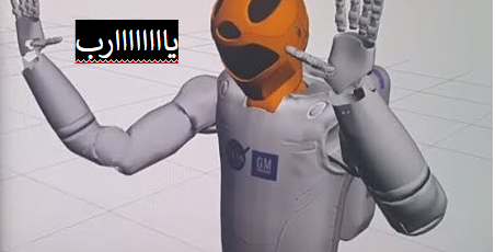
and generate path and track this path to can avoid the trash as in picture

Space Agency Data
Space Debris and Human Spacecraft
Orbital Debris and Human Spacecraft
More than 27,000 pieces of orbital debris, or “space junk,” are tracked by the Department of Defense’s global Space Surveillance Network (SSN) sensors. Much more debris -- too small to be tracked, but large enough to threaten human spaceflight and robotic missions -- exists in the near-Earth space environment. Since both the debris and spacecraft are traveling at extremely high speeds (approximately 15,700 mph in low Earth orbit), an impact of even a tiny piece of orbital debris with a spacecraft could create big problems.
The rising population of space debris increases the potential danger to all space vehicles, including to the International Space Station and other spacecraft with humans aboard, such as SpaceX’s Crew Dragon.
NASA takes the threat of collisions with space debris seriously and has a long-standing set of guidelines on how to deal with each potential collision threat to the space station. These guidelines, part of a larger body of decision-making aids known as flight rules, specify when the expected proximity of a piece of debris increases the probability of a collision enough that evasive action or other precautions to ensure the safety of the crew are needed.
Orbital Debris
Space debris encompasses both natural meteoroid and artificial (human-made) orbital debris. Meteoroids are in orbit about the sun, while most artificial debris is in orbit about the Earth (hence the term “orbital” debris).
Orbital debris is any human-made object in orbit about the Earth that no longer serves a useful function. Such debris includes nonfunctional spacecraft, abandoned launch vehicle stages, mission-related debris, and fragmentation debris.
There are approximately 23,000 pieces of debris larger than a softball orbiting the Earth. They travel at speeds up to 17,500 mph, fast enough for a relatively small piece of orbital debris to damage a satellite or a spacecraft. There are half a million pieces of debris the size of a marble or larger (up to 0.4 inches, or 1 centimeter) or larger, and approximately 100 million pieces of debris about .04 inches (or one millimeter) and larger. There is even more smaller micrometer-sized (0.000039 of an inch in diameter) debris.
Even tiny paint flecks can damage a spacecraft when traveling at these velocities. A number of space shuttle windows were replaced because of damage caused by material that was analyzed and shown to be paint flecks. In fact, millimeter-sized orbital debris represents the highest mission-ending risk to most robotic spacecraft operating in low Earth orbit.
so .. We mapping the space and trashes as obstacles, can avoid it by some the AI and Algorithms applied on the map technically to get the shot path but to can map, we could be to localize our orbit concerning Map and to create a map we must localize our orbit so it's an egg chicken problem by applying so we should apply the (SLAM) concept which is
SLAM has been the subject of technical research for many years

Hackathon Journey
was great we worked on a lot of tools and models to generate something useful how this competition transfer us from regular state to space and NASA states!!
References
for NASA data
https://www.nasa.gov/mission_pages/station/news/orbital_debris.html
ROS framework to can visualize the sensor fusion
http://wiki.ros.org/Documentation
get some of the syntaxes to python to can generate a machine vision model
https://www.hackerrank.com/domains/python
to generate an AI model to predict the new pose of the debris
https://scikit-learn.org/stable/modules/generated/sklearn.linear_model.LinearRegression.html
Tags
#AI #MACHINELEARNING #ROS #IMAGEP_PROCSSING #ROBOTICS
Global Judging
This project has been submitted for consideration during the Judging process.