Awards & Nominations
AD ASTRA has received the following awards and nominations. Way to go!
Global Nominee

AD ASTRA has received the following awards and nominations. Way to go!
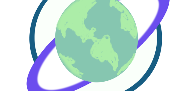
We developed a web application which is based on NASA's WorldWind which was modified in order for us to keep track and plot orbiting objects and stars. In particular, our system keeps track of satellites, rocket bodies and space debris in the main orbits of Earth. Moreover, one of the most important propositions of our project is the computation of a ‘Risk Value’, which is the predicted probability of collision following a Bayesian model. Furthermore, our app is open source and relies on open sourced data, which if successful, it’ll gain easy adoption for the community to use and maintain. Our proposal is relevant because the tracking-estimation system would enable a tool for early warning.
Our proposal includes development of the Orbit Web Debris Tracker (O.W.D.T.), an open source system that consists of a tracking system, as well as a collision prediction estimate. Our tracking component was developed as a web application written in JavaScript with Node and Vue3. With this component, a modified implementation of NASA's WorldWind is used as the main interface allowing us keep track of orbital objects. The application relies on the TLE data provided from Celestrak (considering NORAD and NASA's GOES data).
This TLE data is cleaned first by filtering those objects whose position computation can't be done, from those who can. The objective is just to render objects whose position is known. Then this TLE data is processed into its orbital information so we can make computations with help of the library Satellite.js including computation of geodetic position, satellite velocity, latitude, longitude, and others which then can be mapped and arranged into our WorldWind implementation, following a similar approach as SpaceBirds but with the advent of less complexity and being updated for newer versions of Satellite.js.
With this design, we're able to keep track of satellites, rockets and debris objects in the main orbits of Earth, considering LEO, MEO, HEO, GEO and an unclassified orbit category. In this regard, our User Interface allows filtering of this data, so the user can choose whether to display an specific orbit or object type. Moreover, our tracker gets updated every few seconds updating the current positions of all the objects in view using its current velocity and last known position.
The second component of O.W.D.T. is a mathematical approach that allows us to compute a risk value, which is the probability of collision of a given object in his orbit .
The main idea is , if we know the starting point of object in the space, then we can draw the trajectory with the angle and geocentricity of this space object , this trajectory will be our segment because wi know de x, y and z points of our space object and we can calculate the velocity of this object.
Then we will apply this method into a second spatial object, and if the probability of colliding is none will be 0 and the more chances to collide the maximum range will be 1.
Calculating the probability of collision for an object Y with object X
P(X) =probability of being in 1 segment of the orbit
P(X being in given segment per second) = k * S/L in [0,1] =(1-e-s/l) =α
S : speed L : length
P(X) = 1 -espeed/length speed = *average speed
speed → ∞
1 - e-∞ → 1 -1/e∞ → 1-0 =1 It will collide for sure
speed → 0
1 - e-0 → 1-1 = 0 It won't collide for sure
length of orbit → ∞
1-e-1/∞= 1-e0=1-1 =0 It won't collide for sure
length of orbit = 0 ?
1-e-∞= 1-1/e∞=1-0 =1 This in an impossible case
P(X∩Y)=(volume of intersection area *2 )/total volume of both circumferences inn [0,1]=β
PCollision( Y| 2 satellites in same space) = P(X∩Y)/P(X)=β₁*β₂*β₃* .... βn / α₁*α ₂*α ₃*....α n
The probability of the interjection will be influenced by the wider of the orbit and the velocity, it means the longer the orbit the less chances to collide but the more velocity in the object the greater the chances to collide with some other object with less velocity.
On a very early stage of our project we started by consuming an open API from NASA called Asteriod NeoWs which would provide us with a number of near Earth objects, close approach dates, relative velocity and so on. This was used mainly as a sandbox for us to grasp a better understanding on how to plot certain objects using that data; however, as we move on into the hackathon added NASA's WorldWind open source code into our project so we can render the Earth and use some references for plotting of stars.
For computational rendering of satellites and debris, we used TLE data from GOES, and NORAD using Celestrak.
Our experience at the hackathon was really rewarding, it was like a roller coaster for some of us, in the sense that we were really excited and like working fully, but there were times where we needed to find solutions to a problem fast so other team members can get their components working. This was a really funny experience because you got lot of work to do in just 48 hours and you got to learn many things from each other so It was rewarding.
One of the main challenges that we had was on the actual rendering of satellite data , but we worked as a team, looking for ways to solve it and eventually one guy come with an idea and it worked, it was great.
Personally, we would like to thank every member of our team, because we found incredible people and very talented as well.
Last but not least we would like thank the crew staff from our local places and of course from NASA.
Tools:
VisualStudio
Python3, JavaScript, Node, Vue, NASA's WorldWind, Firebase.
References:
https://www.nasa.gov/mission_pages/station/news/orbital_debris.html
#SpaceDebris, #Debris, #TrackingSystem #DebrisTracking #
This project has been submitted for consideration during the Judging process.
The increasing amount of debris orbiting Earth could potentially limit our access to space, impacting not only exploration efforts, but routine aspects of our life on Earth. Your challenge is to develop an open-source geospatial application that displays and locates every known debris object orbiting Earth in real time.