
High-Level Project Summary
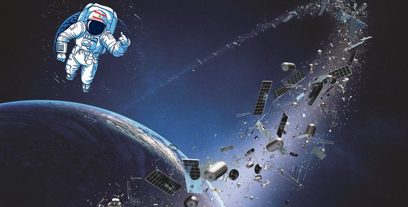
The increasing amount of debris orbiting Earth could potentially limit our access to space, impacting not only exploration efforts, but routine aspects of our life on Earth. Our project is an open-source application that displays and locates known debris objects orbiting the earth visualized on a 3D globe. Filters are added to help users facilitate tracking and future conjunction assessment feature may be included to anticipate risks of collision. All space agencies around the world intend to help predicting and solving human-kind problems, however without putting efforts on locating and cleaning up the debris mess out there, all other space missions become hopeless.
Link to Project "Demo"
Link to Final Project
Detailed Project Description
Introduction
Today there are nearly 22,000 artificial objects in Earth orbit, including 6,444 spacecraft (active and defunct). However, these statistics include only the objects large enough to be tracked. More than 128 million pieces of debris smaller than 1 cm (0.4 in), about 900,000 pieces of debris 1–10 cm, and around 34,000 pieces larger than 10 cm (3.9 in) are estimated to be orbiting Earth. Our solution will help track those trash and provide filtering options according to size, period, object type and source country to narrow down the sample to visualize. Future enhancement will include conjunction assessment and risk of collision calculation to guide the user for the best course to take to avoid damage as much as possible.
Projects Details
How does it work?
Starting by studying the problem characteristics and effects, we wanted to make sure we develop a realistic solution that could provide some benefits in the most important aspects of any space mission plan: the collision avoidance and conjunction assessment.
The methodology employed during the implementation of this project is illustrated in the following diagram:

- First the space objects’ data are collected through the API (Application Programming Interface) provided by Space-Track (which we understand was built closely with CelesTrak).
- The data are then parsed and processed in order to obtain a JSON array of objects. Each object dictionary includes the object’s coordinates and required properties.
- Once the data is ready, the objects are mapped into a 3D globe embedded within our geo-browser web application. This application is based on the threejs library provided through its platform.
- Filters are then added for better visualization and interpretation. They include object type, country source, period, object size.
- Finally, we developed the concept of some interesting features that help minimizing the risk of collision and taking early protective precautions.
How did we develop this project?
The methodology employed was designed and implemented in a flexible, well-structured and expandable web application which is based on HTML, CSS and JS (JavaScript) markup and programming languages.
Various libraries are used in order to parse, process, map and display the objects to the 3D Globe, including threejs, Satellite, Three, Three-globe, Three-interaction for 3D rendering and display, lodash for modularity and performance, and date-fns for date manipulation. On top of them, we also added the filters and implemented the concept of collision avoidance and conjunction assessment features.
The outcome of this hackathon is hosted on http://cedarx-nasaspaceapps.vivida.me
The source code is publicly published on GitHub and can be accessed through this link: https://github.com/ahmad-moussawi/track-space-debris
What benefits does it have?
Our project provides an array of benefits that contribute to assisting present existence and future cosmic plans organized by space agencies. The tracking platform that we built will help avoid the risk of collision. On February 10, 2009, an inactive Russian communications satellite, designated Cosmos 2251, collided with an active commercial communications satellite operated by U.S.-based Iridium Satellite LLC. This active satellite provides L-band mobile telephone and communications services to users on the ground. Thus, dead satellites and space debris are considered a threat to active satellites that provide us with assistance in communication, navigation, streaming and various daily luxuries.
The prototype that our team has designed is responsible for minimizing the threat by tracking space trash and avoiding the risk of collision through early protective precautions. Eventually, we will be able to preserve active satellites like the Iridium mentioned above.
In addition to that, this tracking system will help protect earth inhabitants. Although most debris burns up in the atmosphere, larger debris objects can reach the ground intact. According to NASA, an average of one cataloged piece of debris has fallen back to Earth each day for the past 50 years.
It is also said that most of these fallen debris are harmless, yet the expected superabundance of orbiting satellites may increase the level of harm against living creatures of the earth.
Moreover, this life changing system can protect astronauts' lives to avoid incidents similar to what happened with the SpaceX crew. The astronauts of SpaceX's Crew-2 mission for NASA had a brief moment of suspense after their spectacular launch on Friday (April 23) when a piece of space debris passed unexpectedly close by their Crew Dragon capsule.
User Guide – how to use the application?
1- 3D Model of The Earth: This model of our globe can be rotated by clicking and holding the mouse pointer anywhere on the globe. Using the cursor, you can zoom in and out by rolling the cursor.
2- Information about debris: can be accessed by hovering the mouse pointer over a specific sphere that represents different debris types.
3- Filters: Different filters can be specified in order to narrow search and show specific data needed for research. These filters are categorized by:
A.Size
B.Type
C.Country of Origin
D.Period
4- Conjunction assessment: Future enhancement that shows risk probability over a specific region, depending on trajectory of particle of debris
5- Satellite list: A list that shows the current satellite location in orbit around the Earth.
Project’s future
Knowing the location, weight and relative trajectory of the particles in space, comparing them with the location of launching or the location of a shuttle or station in space, the user will be able to make decisions based on the given information.
Using filters to narrow down search and provide accurate analysis of the data needed, simulations are available to provide an idea of what precautionary measures can be taken to minimize damage, where risk probabilities are calculated and assessed then maneuvers such as replacement routes, launch sites, protection measures and more.
We think it's important to study the effect of applying some machine learning techniques (clustering for example) on space debris in order to extract some characteristics or trend of flow for better collision avoidance, risk assessment and decision making,
Based on the event that happened on May 12 2021, where a routine inspection of a robotic arm on the International Space Station revealed a five-millimeter-wide hole in its thermal covering. According to a statement by the Canadian Space Agency, the robotic arm known as Canadarm2 collided with a small piece of orbital debris.
Using the conjunction assessment and collision avoidance process that NASA last implemented, as well as debris tracking methods and trajectory analysis, users can view every aspect of risk factors that are shown on the 3-D model of the globe avoiding the occurrence of incidents similar to the ISS robotic arm. Depending on the size, shape, trajectory and speed of the particle, users will be able to see and choose a safety maneuver that will decrease any chance of major damage.
Such precautions are to be taken after predicting an event of collision. For instance, as NASA uses an imaginary box to predict precautionary maneuvers, using a 4 x 50 x 50 km3 area around the shuttle or station in space as boundaries or danger zone, to assess any nearby threat or risk of collision with a particle of any size.
Space Agency Data
For our solution, we used information and data gathered from NASA and Space Track, as well as documentaries and articles extracted from National Geographic and the ESA website.
This data was used to set filters for facilitating data extraction from the application, it also helped with setting accurate information and give a perfect representation of what data should be translated into code for interactive modules.
Hackathon Journey
Our journey can indeed be described by two words "Collective Perseverance". During the team formation phase, the CEDAR X team was found. We began to read about each challenge until we found one that caught our interest. Our choice of the Mapping Space Trash In Real Time challenge can be justified by the previous incidents that have been encountered by space agencies. Throughout the last two decades, the increasing number of collisions in space due to cosmic trash served as an inspiration to find a solution to this devastating problem.
Our approach was a three phase process where we collected data and implemented them after several brainstorming sessions. However, like all challenges, we had a encountered some obstacles, yet we resolved everything by scheduling meetings and discussing everything together as a team.
References
Space junk facts and information
Space Debris: Models and Risk Analysis
ESA - Space debris: assessing the risk
ESA - Automating collision avoidance
ARES | Orbital Debris Program Office
Machine Learning Improves Debris Flow Warning - NASA/ADS
Used in pitch:
https://www.youtube.com/watch?v=501FEzbB1JI
https://www.youtube.com/watch?v=8eo2bezLy6Y
https://www.youtube.com/watch?v=Rh_wo0A-MCU
Tags
#space #junk #debris #satellite #orbit #mapping #tracking #risk_assessment #live_tracking
Global Judging
This project has been submitted for consideration during the Judging process.