
High-Level Project Summary
Did you know that we are at significant risk of ending all means of communication and shutting ourselves off from space? In our space there are 36500 objects greater than 10 cm, 1000000 objects from 1 cm to 10 cm and 330 million objects from 1 mm to 1 cm. The space is filled with trash pieces from the missions dispatched, and these pieces only collide to create more trash triggering a never-ending chain of space debris growth. But we have the solution, an interactive web application that provides real time location and predictions of them in real time in an interactive map providing information such as (geospatial, velocity, type, date, time) not only that but the app can predict crashing.
Link to Project "Demo"
Link to Final Project
Detailed Project Description

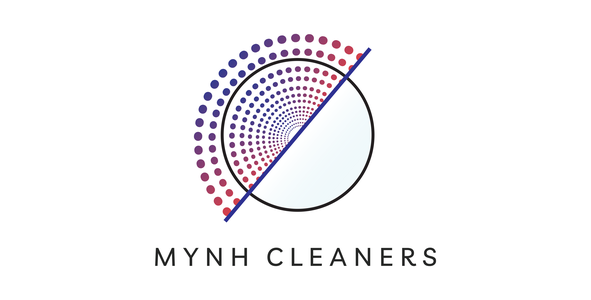
Logo concept
Our website application is presenting the problem, explaining the solution, and inviting the user to take the next step. As the color dots representing pieces of space debris approaching Earth. Moving to the white straight line represents our solution "MY NH CLEANER". This is a web application that scans the earth and maps each debris to clean our beloved earth.
Project Description:
It is a web App that contains open-source geospatial virtual NASA World wind which is a representation of the Earth which provides the user with the ability to move around in a virtual environment by changing the viewing angle and position. Compared to a conventional globe. World Wind is a computer program that shows a 3D globe of the earth. An SDK (software development kit) is a special tool that we used to build our own app. World Wind is a program that provides a geographic rendering engine for powering debris and satellite tracking systems in earth orbitals. For every object in space, we have a path that starts from Earth and goes around it. We also used celestrak to help predict the movement of artificial earth satellites and debris. By using Python's SGP4 we obtain the geographical position of the tracked object (altitude, latitude, longitude) using the orbital parameters that the object revolves in at the current time. After getting the geographical position of the tracked object we locate it in a geospatial library which is OWSLib. It’s OGC Open Web Services (OGC OWS) client-side implementation using Python programming language that offers us access to a wide range of spatial data, web services, analysis and processing. The process is repeated to all objects in our selected category.
Our category will contain space stations, satellites, large rocks & meteorites and (Large, medium, and small) debris. Each fraction of a second the tracked objects' positions is updated providing a real-time animation of every space debris and other objects in the catalog. Users of the app can see a 3d model of earth with the tracked object revolving around it, by selecting any object from the user interface (UI) you can see the details of the object like (geographical position, velocity, type, date, time). In addition, there is a timeline feature to allow the user to see the orbital environment at a different point in time. Users can Also select a location on Earth's surface and see the predicted time for a certain object to pass over this location. This time will be predicted using machine learning.
Project Code Strategy:
 Step 1
With the Worldwind open source we will create our 3D interactive globe to visualize the derbies surrounded Earth. We choose Worldwind as it is available for desktop, mobile, and web browser applications. We plan to use the following Code files from the library. Argument Parsing, Deep picking, Geolocation, Measurement, and Region Picking
Step 2
In the following step we will Extract Data from NEOSSAT - Astronomy Data and Celestak. Through the following link, we will extract, clean, filter the data to extract debris and junk data. http://asc-csa.gc.ca/eng/satellites/neossat/default.asp. This dataset includes astronomical Images from closer to the earth Object surveillance satellite (NEOSSAT). As it can detect and track the asteroids and satellites at an altitude of about 780 KM above the earth. The other option is Celestak https://celestrak.com/NORAD/elements/ as a dataset for obtaining the required information to use to map the trash objects.
Step 3
After we will obtain the required data, Python's SGP4 is a python page that can compute the exact position and velocity of the earth obtaining satellite. Hence; we can enhance the code package to fit in with our problem to map the debris. Using Python's SGP4 and the extracted data from CelesTrak or NEOSSAT - Astronomy Data, we will be able to justify the exact location for the specific debris, its longitude, latitude, and altitude.
Step 4
Step 4 including the mapping process and displaying our results into the geospatial Wroldwind library that we use at first. Resulting we will have the following outputs as in the below photo. All the tracked debris is shown in the user interface that we will create.

Step 5
In this step to achieve the goal of mapping in real-time the problem, using the same python package with adding and editing particular parameters in the code to update the time each second and display the result in the UI of our web application MYNH CLEANER.
Step 6st step and the most important step for our solution show the added value that we bring to the problem. By using the same parameter that we extract and the resulting parameter such as time, inclination, direction, position. We will be able easily to predict if there are any debris, satellite, asteroids, and any artificial object that will collide in the future. By that, we will solve another problem which is providing expensive materials and sensors in the satellite to avoid colliding. Just with a simple code satellite will be safe. Besides, reduce and solve the major problem which is tracking the trash in Actual-time.

MYNH CLEANER USER INTERFACE

User interface experience
The web application is quite simple to use. The first window shows our logo which is an earth surrounded partially by debris that is being cleaned, in the top right corner of the window are two buttons, the about button and the “help” button which has FAQ and a description of what some of the terms mean.
When clicked on the “about” button it shows a description of the app and the problem it solves. In the middle of the window is the “Launch” button which moves us to the next window to start tracking debris in real time.


The next window shows an animated interactive map of the earth and the debris circling around it, the user may click on any point on the globe, and it zooms in on that point and takes them to another window to display the information of the debris. The information includes the type, longitude, latitude, altitude, inclination, velocity, date, and the time of the specific debris. On the top right corner of the window there is a search bar in which users can search for a specific location to find all the debris that locate above this area on Earth.


At the bottom of the window are two buttons a prediction button that shows predictions about the location of the debris and whether debris will pass over a certain area or not. Besides the possibility of a collision with other debris or any space objects. In addition to a description debris button that states the type of the debris whether it is natural or artificial and such.

Space Agency Data
We will extract data from NEOSSAT - Astronomy Data and Celestak. This data set includes astronomical images from NEOSSAT satellites. Information from the NORAD database can be used to find garbage objects. After we get the data we need, the SGP4 Python page can do some fantastic things like compute the exact position and velocity of the earth and get satellite data. As a result, we can improve the code package to fit our problem, to map the debris. Using Python's SGP4 and the extracted data from CelesTrak or NEOSSAT, we will be able to justify the exact location for the specific rubble, its longitude, latitude, and altitude. With open source WorldWind we create our interactive 3D globe around the earth within the derbies. We choose WorldWind as it is available for desktop, mobile, and web browser applications. Use the same python package, add, and edit specific parameters in the code to update the time every second and display the result in the UI.

Hackathon Journey
Why we addressed this problem:
Space debris is a threat to all means of communication across the globe, and as the mainstream focuses on an earth with zero trash, we saw the importance of bringing attention to the space debris problem. and a space with zero trash because space for all of us humans represent hope and opportunities.
We would also like to mention the concept of mega constellations, which will consist of thousands of satellites, is being investigated by several companies. Companies such as SpaceX and Amazon plan to launch thousands of satellites to achieve worldwide satellite internet coverage. On the off chance that fruitful, there could be 50,000 extra satellites in orbit. This means that more maneuvers will need to be done to avoid collision with other ships. And tracking space debris should be more accurate and accessible than ever.
Our approach
We want to create an application that can be used by officials and the public that can display animated descriptions of space debris in orbit in real time to raise awareness of the growing problem and the degree of danger in orbit. Ironically The thing is, the more humans try to enter space, the greater our chance of being isolated from space. And because of this, we hope that stricter regulations and more governments are investing in space debris removal.
Future plans
- If we had more resources, we would implement quantum computing in solving this problem since the growth of the debris is exponential our method to stop it should be of the same rate, using quantum computing we can predict the location of space debris exponentially fast and accurately.
- It can also predict the possibilities of debris crashing together which can put a limit on the exponential growth of the space debris while simultaneously providing the data to companies to assist in the process of space debris removal. Thus, the application can also provide information on the safest possible orbits for satellites to release or to maneuver them in case of a large debris coming close. Using AI, we can also predict if one debris is going to crash together, creating a hazard, and trying to prevent it.
- Another amazing addition that quantum computers can make is a way to instantly communicate with each other no matter how far their qubits are. This is useful for real-time tracking of debris and fast communication in time of a crisis. And this proves to be an innovative addition to the space app.
Team Members

Our Journey in a Photo

References
· https://www.esa.int/Safety_Security/Space_Debris/Space_debris_by_the_numbers
· https://www.nhm.ac.uk/discover/what-is-space-junk-and-why-is-it-a-problem.html
· https://www.esa.int/Safety_Security/Space_Debris/Active_debris_removal
· https://spie.org/news/4076-clearing-space-debris-with-lasers?SSO=1
· https://calhoun.nps.edu/bitstream/handle/10945/1233/04Dec_Kalinski.pdf?sequence=1&isAllowed=y
· https://www.esa.int/Safety_Security/Space_Debris/Hypervelocity_impacts_and_protecting_spacecraft
· http://stuffin.space/?intldes=1992-093HT
· https://www.nationalgeographic.com/science/article/space-junk
· https://www.youtube.com/watch?v=Ctvzf_p0qUA
· https://www.nasa.gov/mission_pages/station/news/orbital_debris.html
· https://www.nap.edu/read/4765/chapter/5#38
· https://donnees-data.asc-csa.gc.ca/en/dataset/9ae3e718-8b6d-40b7-8aa4-858f00e84b30
· https://sandcastle.cesium.com/?src=Custom%20DataSource.html&label=DataSources
Tags
#Join #AI #artificial intelligence #Heroes #Heroines #NASA #Mascot #ScienceRocks #ScienceIsFun #spacetrash #geosptail_technology #satellite_images #sustinable_development #satellite_prediction # Globe data # space prediction # time prediction # satellite_based data
Global Judging
This project has been submitted for consideration during the Judging process.