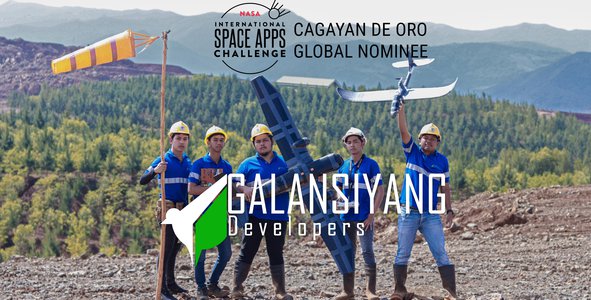
Awards & Nominations
Galansiyang Developers has received the following awards and nominations. Way to go!
Global Nominee

Galansiyang Developers has received the following awards and nominations. Way to go!
Planting trees on deforested areas, especially on mined-out regions, have always been our initiative to mitigate the effects of climate change and bring back the natural state of deforested lands. However, problem emerges after this initiative, how can we monitor these vast growing trees without solely relying on manual human observation? This process of forest monitoring can be a massive cost and time consuming. Thus, we introduce LANTAWA, a web-based app that utilizes the NASA's GIS earthdata and LiDAR technology with RGB scanning drones to monitor rehabilitated land status and to empower communities, industries and policy makers against environmental injustices by automating forestry.


SUMMARY OF THE PROBLEM

The project name is a Bisaya (a Philippine language) word "lantawa" which means to look, to see, or to inspect.


BRIEF METHODOLOGY
I. Drone Modification
A multirotor UAV drone will be modified for mapping and scanning on post-mining sites. Materials are to be assembled and electronics are to be properly connected.
II. Drone integration and NASA's earthdata incorporation with LiDAR technology and GIS
Drone will be integrated with the LiDAR and NASA's GIS earthdata for the best aerial & aerospace gathering of data. Data gathered from NASA's earthdata will also be incorporated in the running system. This process will secure sharper ground perspective for data analysis of the canopies.
III. Web App Development (Alpha-type)
NASA's earthdata provides the necessary input to generate GIS-based imagery and other details using QGIS webmap.
The use of LiDAR technology and NASA's GIS earthdata provides sharp data on the better classification of trees, a more accurate modelling of the canopy layers, ground topography and biomass estimation; it can penetrate in the vegetation of a forest in order to produce a digital terrain model (DTM) and get inside-canopy for tree species identification, height and size measurements or volume of wood per hectare. All the gathered data will be uploaded to a web-based server then render it on an AI software to produce the needed information. Thus, creating a responsive web application with artificial intelligence (AI) to show GIS results, tree count, size, height & heath, tree species identification & classification, calculation of carbon sequestration, wildlife identification and display the actual digital 3D forest.
Github link for the code and QGIS file:
https://github.com/jaylamberte99/lantawa
Drive:
https://drive.google.com/drive/folders/1MpPcW0DDQa9e1tEnJ7KJBrrU9Q1PRS8J?usp=sharing

PROCESS FRAMEWORK
In order for the metal and mineral industry to avoid closure and continue their operation, they must secure their environmental permit once they are able comply to the environmental regulatory policies.
As it was stated in the Vegetation Characteristics and Processes Data section,
Vegetation is a primary component of terrestrial biodiversity, playing a critical role in the global energy budget and in many of our biogeochemical cycles. Maintaining species richness ensures the productivity and stability of ecosystem processes, making it critical to monitor vegetation health.
Thus, LANTAWA was inspired to use this data to cater a healthy and innovative post-mining rehabilitation system that can guarantee a feasible output, promote responsible mining, and empowering the communities, industries and government against environmental injustices by automating forestry!

Considering that our team has been on hiatus since the start of pandemic, when our startup operations halted for safety protocols, this challenge became an opportunity for us to showcase again the grit and the hustle towards our love for innovation. The experiences we obtained in this hackathon from idea stage to prototyping, and from prototyping to small scale deployment (alpha version), reminded our team that we are participating in something that can actually make a change for our world, and not just for our world, but in any space that we occupy.
Eager to bring back the once lush forests and once healthy planet, LANTAWA has been created. The drive to automate the vegetation restoration of the disturbed or mined-out land areas and monitor the growing or existing forests is the fuel of our team to attenuate the effects of climate change while helping mining and quarry industries to be more sustainable.
We can never deny that climate change is affecting our lives. Thus, this project is not just to showcase our skills in science and technology but rather our approach is geared towards solving real global problems. And although this may seem unattainable now but surely our journey does not end here in this 2-day hackathon.
This is Joshua Fernandez - Electronic Technologist, Maynard Costanilla - Communication Technologist, Jay Gajudo - Drone Developer, Jay Lamberte - Software Engineer, Jiko Colita - I.T professional; and we will continue to empower communities, industries & policy makers against environmental injustices by automating forestry!

DATA SOURCE:
https://earthdata.nasa.gov/learn/pathfinders
https://earthdata.nasa.gov/learn/pathfinders/biodiversity/vegetation-characteristics
https://lpdaac.usgs.gov/products/mod13q1v061/
https://daac.ornl.gov/cgi-bin/theme_dataset_lister.pl?theme_id=1
RELATED LITERATURE:
https://www.unenvironment.org/explore-topics/resource-efficiency/about-resource-efficiency
http://www.alexandrina.org/CSSP/Event/Material/MEA_businessesdocument.353.aspx
https://doi.org/10.1088/1748-9326/aa7760
https://doi.org/10.1126/science.1201609
https://doi.org/10.1016/j.foreco.2015.06.014
https://doi.org/10.1111/j.1467-8489.2012.00588.x
https://doi.org/10.3390/su4092099
https://pubs.er.usgs.gov/publication/mcs2020
https://mineralseducationcoalition.org/mining-mineral-statistics
https://doi.org/10.3133/mcs2020
https://doi.org/10.1016/j.gloenvcha.2018.02.008
https://doi.org/10.1038/s41597-020-00624-w
https://www.econstor.eu/handle/10419/211058
http://hdl.handle.net/11540/10272
http://hdl.handle.net/10419/149109
#climatechange #forestry #trees #drones #mining #reforestation #climatemitigation #resourcemanagement #earthscience #web-based #monitoring #remotesensing #vegetation #empowerment #community #industry #governement
This project has been submitted for consideration during the Judging process.