
High-Level Project Summary
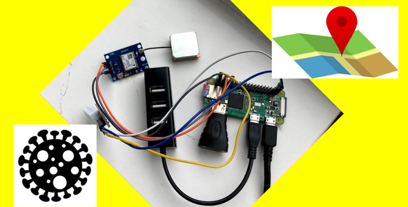
Using Raspberry Pi, GPS receiver and temperature sensor, we can know where we are and what the temperatures and humidities around us are. The location can be turned into Google Map link.With the information of where we are, PVI, “risk factor" can take in a number of account number such as Covid cases, deaths and etc around the location.All the information go into kintone after running the program.
Link to Project "Demo"
Link to Final Project
Detailed Project Description
Using Raspberry Pi, GPS receiver and temperature sensor, we can know where we are and what the temperatures and humidities around us are. The location can be turned into Google Map link.
With the information of where we are, PVI, “risk factor" can take in a number of account number such as Covid cases, deaths and etc around the location.
All the information go into kintone after running the program.
Space Agency Data
We used CDC's Pandemic Vulnerability Index (PVI) data. We plan to use NASA's environmental monitoring data such as UV monitoring data.
Hackathon Journey
We learned a LOT!
References
COVID-19 Pandemic Vulnerability Index (PVI): https://covid19pvi.niehs.nih.gov/
Tags
#covid19
Global Judging
This project has been submitted for consideration during the Judging process.