
High-Level Project Summary
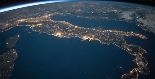
Our goal is discussing and evaluating satellite data's influence, provided mainly by NASA, on solving grand challenges like natural disasters, energy crises, animal conservation, global warming, etc. After analyzing and researching stories on "Space for U.S." from different states and topics, we started visualizing data from the resources provided and comparing the results to measure these earth observations' value. We've researched the heat crisis in phoenix, the volcanic threat in Alaska, the sturgeon fish in the Atlantic, and other stories to reach for a strategy based on specific standards to help us in our target, which is calculating the efficiency of satellite data in solving problems
Link to Project "Demo"
Link to Final Project
Detailed Project Description
We addressed a number of times where EO Data contributed to the greater good and humanity’s flourishment :
1-Phoenix’s Heat Problem:
Inside maricopa county lies Phoenix which is known to many as "the valley of the sun" and notoriously known for its extremely high temperature. This extreme temperature is mainly due to its urban architecture, lack of vegetation, climate change and low humidity. Phoenix is also known as a heat Island a term for a city which has become exceptionally hot due to the combination of many urban trademarks like towering glass buildings, bustling industry, vast amount of concrete and asphalt which absorbs and amplify the heat of the sun. This extreme heat has caused the city to have a record of heat deaths of 182 and heat related deaths of 197 in 2019. To add insult to injury, phoenix's increasing extreme temperature negatively affect the economy, air quality, and most importantly public health. The only ways of coping with the heat were by adaptation behavior like avoiding going out in extreme heat or mitigation behavior like planting trees. If the problem is left unsolved, there will be major consequences since phoenix will become hotter because of climate change and increase in urban structure causing more deaths every year. MCDPH and Arizona State University teamed with NASA DEVELOP in the Earth Applied Sciences Program to develop a system using satellite data to measure the data variability of temperature across phoenix from 2005 to 2014. This helped the team deduce the s spatial patterns of heat. This data can be used to determine what regions need attention the most and treatment regarding heat. Nasa's research has influenced the actions of many decision-makers like the "cooler phoenix" initiative and "nature conservatory" and can in the future be a major contributor in phoenix's methods of dealing with its heat problem.
2- Volcanic Ashe And Alaska’s Aviation System:
Alaska, the marvelous, snowy, and lovely land, is the hometown of 80% of the active volcanoes in the United States. Alaska could be breathtaking on tv, but not for the Alaskans neither the 25,000 passengers. The planes transit over volcanoes in Alaska daily, which threaten them by volcanic eruptions that push ash clouds into the air. Ash is hazardous because microscopic silica can scratch windshields and shut down the engines, like the 2010 Icelandic volcanic eruption incident.
Now, NASA, NOAA, and satellite data come into play. By integrating satellite data, volcanic clouds are tracked by their chemical composition. In particular, the satellites detect the sulfur dioxide composition of the ash clouds to identify their location and where they are going.
In January 2020, thanks to satellite data, volcanic ash was predicted to be shot at an estimated height, which led to the delay of the flights and avoided the ash risks. The data from the Alaska volcano observatory, which is based upon satellite data, has helped a lot in the noticeable decrement in the affection of volcanos on airlines in the past few years. This technology is expected to improve in the following years; the faster the forecasters will receive this new volcanic ash information in the future, the faster they will be able to provide pilots with updated information.
3-The Atlantic surgeons in Delaware bay:
The Atlantic sturgeon belongs to the category of ancient bony fish, which can live up to 60 years, grow up to 4 feet long, and weigh more than 800 pounds. The Atlantic sturgeon is anadromous, which means that, like the Delaware River, it is born in fresh water, lives in the ocean until it is fully developed, and returns to spawn (lay eggs) in the river in which it was born. In the Delaware River, they spawn in the freshwater section of the estuary at the bottom of the river. The youngsters spend several years in the river before moving to the Atlantic. After spawning, the sturgeon returns to the sea; They can begin to spawn several times during their life.
The Delaware River sturgeon was once the largest population on the Atlantic coast. They were very popular for their eggs. In the late 1800s, Philadelphia was known as the "caviar capital of North America"; The ensuing overfishing, habitat loss and water quality problems have led to its decline.
In 2012, the federal government classified the five individual populations of the Atlantic sturgeon as endangered; The Delaware River is part of "New York Bay" and is considered critically endangered. 4,444 deaths from ship collisions, habitat destruction and deterioration of water quality threaten today's population. While recent studies in the Delaware River Basin have shown some success in spawning
More than a century ago, an estimated 180,000 female Atlantic sturgeon came from shore to spawn in the Delaware River in the spring, and fishermen sought their caviar as a lucrative export to Europe. However, overfishing contributed to a sharp decline in the population and today the numbers have dropped to fewer than 300 adults. 4,444 researchers from the University of Delaware and Delaware State University use satellites, acoustic transmitters, an underwater robot, and historical records to determine the marine conditions that fish prefer during their migrations, and possibly to help fishermen avoid places where they might. accidentally catching this endangered species.
"There are certain observable waters in the ocean that we think may be more closely related to this species," said Matthew Oliver, assistant professor of oceanography at UD's College of Earth, Ocean and the Environment.
Nasa satellites
Matthew Oliver and his PhD student Matt Breece compared satellite data from recent years on sea temperature and chlorophyll content with places where sturgeon were previously tracked on their migration along the mid-Atlantic coast. Based on the patterns they found between the data sets, they now use updated satellite information to make rough daily predictions of where sturgeons are migrating.
They test their predictions by directing a torpedo-shaped robot called an Oceanographic Telemetry Identification Sensor (OTIS) glider to these locations to check for sturgeons. 4,444 UD researchers partner with Delaware's Dewayne Fox, who tagged hundreds of Atlantic sturgeons with transmitters to keep track of where they are. The tags trigger alerts when fish pass multiple receivers in the Delaware Bay, and the glider extends that range by adding the tags as well.
To understand the regulatory and operational needs of commercial fishers, Breece said Ed Hale, Delaware Sea Grant Marine Advisory Specialist and Assistant Professor at UD, was instrumental in eliciting feedback from fishers and state administrators. The team also held a series of informal meetings and phone calls with DNREC and local commercial fishermen, and attended three meetings of the Atlantic States Marine Fisheries Council to discuss bycatch to obtain community feedback and information.
Ultimately, the information was packaged into an online tool that predicts the appearance of the Atlantic sturgeon for the current date and three days in the future.
The areas covered by the tool include five regions: the Delaware River, Upper Delaware Bay, Middle Delaware Bay, Lower Delaware Bay, and the Atlantic Ocean. Each of these areas is divided into tanks five meters deep. The tool is also color-coded, where green represents low risk for a full-blown Atlantic sturgeon encounter, yellow represents .
How we developed this project:
We first checked the website named “Space For US”, which is owned by Nasa Applied Science, to pick a number of times where the data from Earth observation and satellites helped deal with problem. After a long meeting, we picked certain topics to research more about. To know more about Phoenix’s heat problem, we checked “Space for US” website and Nasa’s website along with the cooler phoenix initiative from World Congress. To know more about Alaska’s Aviation System and Volcanic Ash, we also checked the section named “Tracking Volcanic Ash for Safer Aviation” in “Space For US” website and “Alaska Volcano Observatory”. To know more about Massachusetts’s Bess problem, we checked the section named “The Sweet Science of Helping Honeybees” in “Space for US” website. After enough research, we determined a strategy we later used how much the data from EO positively affected humanity regarding the resources conserved or lives saved. After determining the evaluation strategy, we then decided to apply it to the chosen times where satellite data helped deal with a problem.
Space Agency Data
-Space for US
https://www.nasa.gov/SpaceforUS/?page=home
Hackathon Journey
We first checked the website named “Space For US”, which is owned by Nasa Applied Science, to pick a number of times where the data from Earth observation and satellites helped deal with problem. After a long meeting, we picked certain topics to research more about. To know more about Phoenix’s heat problem, we checked “Space for US” website and Nasa’s website along with the cooler phoenix initiative from World Congress. To know more about Alaska’s Aviation System and Volcanic Ash, we also checked the section named “Tracking Volcanic Ash for Safer Aviation” in “Space For US” website and “Alaska Volcano Observatory”. To know more about Massachusetts’s Bess problem, we checked the section named “The Sweet Science of Helping Honeybees” in “Space for US” website. After enough research, we determined a strategy we later used how much the data from EO positively affected humanity regarding the resources conserved or lives saved. After determining the evaluation strategy, we then decided to apply it to the chosen times where satellite data helped deal with a problem.
References
[1]https://www.nature.org/content/dam/tnc/nature/en/documents/Phoenix-Arizona-Heat-Action-Plan.pdf
[2]https://worldcongress2018.iclei.org/wp-content/uploads/04.-Cooler-Phoenix_ICLEI-Webinar.pdf
[3] https://www.nasa.gov/centers/johnson/home/phoenix_heatwaves_feature.html
[4] https://www.alaskaasp.com/
[5] https://avo.alaska.edu/volcanoes/hazards.php
[6] https://www.reuters.com/article/us-alaska-volcano-idUSKBN1Z7097
[7] https://urbanbeelab.org/research/
[8] https://develop.larc.nasa.gov/projects.php
[9] https://bestbees.com/2020/10/09/how-nasa-data-helps-us-look-at-bee-health-from-a-new-perspective/
[11] Sturgeon warning system | UDaily (udel.edu)
[12] Delaware River Basin Commission|Living Resources: Atlantic Sturgeon (nj.gov)
[13] https://climatechange.ucdavis.edu/news/becoming-arizona-lessons-from-phoenix/
Tags
#science_application #knowledge #Arizona #Alaska