
High-Level Project Summary
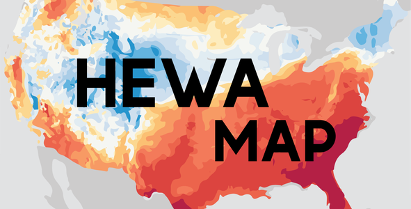
According to the EPA, every year, an estimated 600 people die from heat-related causes. Coupled with the fact that climate change has both stretched out, and intensified heatwaves, provides a jarring future.This is where HeWa Map comes in. HeWa map is an interactive web app that would allow users to see areas with the most forecasted heat risk 7 days out, and recommend actions for users to prepare for an oncoming heatwave. Based on forecast weather data from NOAA, drought presence, and current temperature from NASA, it calculates the present as well as future heat risk and advises users accordingly.
Link to Project "Demo"
Link to Final Project
Detailed Project Description
HeWa Map allows users to see future heatwave risks in their area, giving them extra time to prepare for it. Basically we are trying to use a 3-level warning metric. Warning levels would correspond to three colors. Green would mean it is safe to go out, Yellow would specify that there is a moderate heatwave threat and a Red Warning would let you know that there is a severe heatwave danger.


To create the Choropleth map[1], we decided to take the following factors into consideration:
- Wet Bulb Temperature[2]: It is calculated on the basis of Temperature and Relative Humidity. A high WBT would mean that the human body cannot cool itself by sweating and it will prove very difficult for survival, even for a healthy human being. WBTs have also been the cause of the recent wildfires in Canada's Lytton[3].

- Drought Area : With the help of the dataset by U.S. Drought Monitor[4] , we were able to feed future date values to the model and predict the drought land area in percentage.

- Search Results: According to a research paper[5], Heat stroke internet searches can be a new heatwave health warning surveillance indicator. That is why with the help of Google Trends, we sought out for data on 'heatwaves' and 'heatstroke' and tried to make sense of it and include it as a factor.

We created our own API based on NOAA’s NFTD REST API that allows us to easily grab 7 day forecasts for humidity, temperature, and wet bulb temperature.
In case of Drought Area Data, we used IBM Watson's AutoAI to automatically find the best model for our dataset and deploy it over the IBM Cloud. Now having deployed over IBM has a big advantage, We can generate a API reference which we can later on integrate with our web application.

In case of Google trend results, google provides an option to download csv files. We can use those csv files to create models that will help us gather data on which region/which time-period do heatwaves occur. Below is an example of using the state data to plot a Choropleth Map using plotly in python:

We hoped to train a linear regression model to forecast future droughts, as well as see which droughts will continue to occur, however we could not get that off the ground due to data constraints.
Space Agency Data
We pulled vegetation index, drought, soil moisture, and air temperature data from NASA’s WorldView, and grabbed forecasted weather data from NOAA. The WorldView data fueled our drought regression model, which combined with the forecasted data, would have allowed us to assess the risk of a certain area to heat waves.
Hackathon Journey
This Space Apps was most definitely a roller coaster to say the least. Throughout the weekend, we were learning new skills and trying to figure out better solutions. We had team members pick up web development skills such as creating a back end and designing your own API, as well as expanding our understanding of heat waves. We were always scouring for more data and how to work with what we had. We had so many ideas that we couldn't take off the ground simply because we didn’t have the data.
We chose this challenge because heat waves are a personal matter to our team. The majority of the team lives in the Indian subcontinent, where heat waves are a frequent and deadly occurrence. People lack air conditioning and the proper shelters to live through a heatwave, and with the cramped living conditions and the blaring smog, creates a situation near uninhabitable.
With HeWa Map, we hope to change that. We hope to forecast, inform, and protect those who are at risk of heat waves and mitigate the effects of it. A new wave of weather is coming, and HeWa Map will prepare us for it.
References
ORDERED REFERENCES
- Wikipedia: Choropleth Map
- Wet Bulb Temperature
- Lytton,Canada Wildfire
- US Drought Monitor
- Heat Wave Search Research
UNORDERED REFERENCES
- What is a Heatwave?
- 7 day weather forecast from NOAA NDFD
- Socioeconomic Data from National Integrated Heat Health Information System
Hoped to use following layers from EOSDIS Worldview:
- NDVI Layer of MODIS Satellite
- Air Temperature Layer
- Soil Moisture
- Aerosol Index
- AIRS
Tags
#HeWaMap #heatwaves #newwave
Global Judging
This project has been submitted for consideration during the Judging process.