
High-Level Project Summary
Satellites for monitoring fires are based on low spatial resolution images, However, is some cases like small fires in urban perimeter and slope areas , fire can not be detected by these sensors. This project aims to develop a system that allows any citizen to register a fire (citizens as sensors), providing a photo with a geotag (photo location). The fire occurrences data is sent to institutions responsible and is also useful for validation of burn monitoring. Another functionality is to send alerts of fires in the vicinity (up to 2 km) of a certain location.
Link to Project "Demo"
Link to Final Project
Detailed Project Description
Context
Information on the location and extent of fire occurrences is important for defining fire fighting and prevention strategies, as well as for assessing ecological and economic damage, and as input data for atmospheric and climate impact models.
Fire monitoring data are useful for various purposes, such as fire fighting, gas emission statistics, scientific work, among others. In particular, fire data have been widely used in fire control plans and are useful in devising strategies that can lead to a reduction in expenses caused by fires in agricultural areas or areas of native vegetation.
What it does and how it works
The project aims to alert society and responsible parties through a mobile application.
MODIS products will be used for generating alerts and also as background view.
Then we will create a backend where this data together with the models will be treated and reliability indexes will be generated both for the machine learning model and for the users, because we want to reduce the positive and negative errors for the notifications.
The third step is to create a mobile application for users to register and be notified according to the alert and the level of criticality of the burning, as well as visualization of the data contained in the base, within the established rules of LGPD or GDPR.
We also intend to use environmental variable (land cover, temperature, precipitation and others) and INPE’s fire dataset in order to generate a fire risk prediction model, using Natural Language Processing. The result is a prediction map that indicates the risk of fire occurrence which will be one of the application's views.
We also intend to use environmental variable (land cover, temperature, precipitation and others) and INPE’s fire dataset in order to generate a fire risk prediction model, using Natural Language Processing (NLP). The result is a prediction map that indicates the risk of fire occurrence which will be one of the application's views.
All resources used (applications and data) are open access.
Benefits
We hope to achieve through citizen science this collaboration people/science to alert users and responsible sectors about fires occurrences and warning about times when they occur more often due to both heat and dry seasons. Thus we can always prevent or even avoid fires in regions where responsible sectors and residents have no way to notify and be notified.
We aim to help the population and, together with the population, help science and create this ecosystem of mutual contributions for the benefit of the planet.
These data would serve both to create alerts for the population and responsible institutions as well as to create a validation database of orbital fire products. After all, who doesn't want field data to train and validate their Remote Sensing algorithms?
Technical Development
The backend application and database studies will be performed using the Python language, along with the FastAPI framework, and will be stored in MongoDB.
The application will be developed in Flutter for use on Android and IOS platforms.
All development will be done using Visual Studio Code.
Space Agency Data
Fire monitoring systems are based on low spatial resolution imagery. Thus, fires whose extension is much less than the spatial resolution of the sensor may not be identified. This is the case, for example, with fires that occur in the urban perimeters of municipalities and are very frequent during the dry season. This Project aims to develop a system that allow citizens to register forest and urban fires (citizens as sensors) through a photo that contains a geotag (photo location).
Spatial coordinate data of fires are sent to institutions that are responsible for fighting and conduct law issues. In addition, these citizen science data are useful for validation (checking for errors of omission and commission) of burn monitoring products (burned area and trouble spots).
Other system funcionality is sent warnings of fires that are occurring next a certain location, such as residence of interested in receiving the alert, airports, protected areas (conservation units and indigenous lands), power transmission lines and others.
The user will receive alerts that are within 2 km of their residence or other place of interest, if they are in an urban area. In the case of protected areas or rural areas, where fire can spread faster, users will receive warnings of fires and fires that are within 10 km.
The system will sent alerts identified by a caption in the visualization map according to their sources: 1) registers sent by citizens; 2) ocurrences detected by MYD14A1.006 (thermal anomalies and fires); 3) occurrences detected by INPE's fire monitoring system.
In other words, the system serves both to send and receive fire alerts.
The system consumes the following data:
- MYD09Q1 product (Aqua Surface Reflectance 8 Day L3 Global 250m), for visualizing Earth surface considering the best pixel in the last 8 days
- MYD09GQ product (Aqua Surface Reflectance Daily L2G Global 250m), for visualizing daily Earth surface (with the possibility of cloud cover and lack of images);
- MYD14A1.006 product (Aqua Thermal Anomalies & Fire Daily Global 1km), for visualizing fire location and sent alerts;
- MYD04_L2 product (Aqua Aerosol 5-Min), for visualizing fire smoke;
- Vegetation fires detected during the last 24 hours (all satellites) provided by INPE's (Brazilian National Institute for Space Research) Queimadas Project, for visualizing fire coordinates detected by satellites other than Aqua and also sent alerts;
- OpenStreetMap (OSM), a collaborative mapping project to make it easy to search places.
But why the Aqua satellite? INPE considers the Aqua satellite as a reference satellite for multitemporal analysis. So we chose to use the MODIS products from this satellite.
Alerts are displayed with a legend according to the level of importance and the user can choose whether to view them by type of place (protected area, urban perimeter or rural area), days without rain (as it has implications for severity and duration of fire) and density of fire points.
The user can visualize where the fires are concentrated in a certain state. This information will be generated from the crossing of INPE’s fire points with a 5 x 5 km grid. That is, how many fire points are in each square of the grid will be counted.
The user can also view the seasonality of fires in a particular state or protected area and see if current fires are below or above the average of the last 20 years. This process consider vegetation fires detected by MODIS/Aqua (reference satellite).
Hackathon Journey
During the journey the team got in sync in an inexplicable way. Each person on the team has a knowledge that perfectly matched the activity to be developed.
We have from geospatial researchers to system development leaders, programmers, physicists, accounting scientists, and an OBA (Brazilian Astronomy Olympics) award winner, an exceptional range of knowledge for the development of the activity.
Each one took their own branch of knowledge and created what would be the best solution for the activity, and the whole team came together in a common agreement, thus gaining speed and flexibility in all approaches.
Team setbacks do happen, so whenever an absence was needed, we all supported it to be solved and came back whenever possible, and the activity was not impacted because each professional of the team was able to meet any demand related to the challenge.
The whole team would like to thank the whole team because leaving their activities aside on a weekend to meet unknown people and develop a project is extremely satisfying. The UFSCAR São Carlos for bringing this challenge to Brazil and exceptionally coordinating the event and giving all the support when necessary, and NASA and all space companies that are in union to solve challenges on behalf of humanity, so all involved deserve the most sincere congratulations for being making a difference in the world. Thank you!
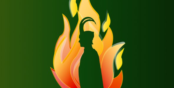
In Norse Mythology, Loki is the god of fire. The group's name is a play on the expression "Look at" with the name of Loki, referring to the phrase "Look at the Earth".
References
[1] FIRMS - Fire Information for Resource Management System
[3] MCD64A1 v006 MODIS/Terra+Aqua Burned Area Monthly L3 Global 500 m SIN Grid
[4] Global Imagery Browse Services (GIBS)
[5] Web Service: MODIS/VIIRS Land Products
[6] Getting Started with the AρρEEARS API: Submitting and Downloading an Area Request
[7] urs.earthdata.nasa.gov/users/new/
[8] Surface Reflectance Global
[10] MODIS Thermal Anomalies/Fire
[11] Programa Queimadas INSTITUTO NACIONAL DE PESQUISAS ESPACIAIS
[12] openstreetmap
Tags
#UrbanFires, #VegetationFires, #EarthObservation, #CitizenScience, #CitizensAsSensors, #MODIS, #Aqua, #FireMonitoring, #Geotag, #RemoteSensing, #Geoinformation
Global Judging
This project has been submitted for consideration during the Judging process.