
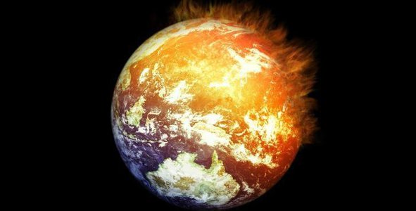
High-Level Project Summary
We propose a tool that allows representing the leading causes and effects of climate change on mobile devices and Web pages through tables, graphs, images, and maps. We will focus in this challenge on Carbon Dioxide, CO2, Methane and Aerosols (PM2.5) as the first causes of climate change [1]. At this time, global data from the National Aeronautics and Space Administration are being used to represent Temperature Anomalies [2].The data represented by the tool will help decision-makers formulate strategies for adaptation and mitigation to climate change. In conclusion, immediate, rapid, and large-scale reductions in greenhouse gas emissions are essential to limit global warming to 1.5C.
Link to Project "Demo"
Link to Final Project
Detailed Project Description
The main objective of the "ModatSpace" challenge is to show the leading causes, effects, and possible solutions to global warming through tables, graphs, images, and maps. The data collected will generate models of the impact of climate change in the short, medium and long term. Our interactive map shows the first causes of global warming: Carbone Dioxide (CO2), methane, and aerosols (PM2.5) [1].
At this time, global data from the National Aeronautics and Space Administration. Goddard Institute for Space Studies are being used to represent temperature anomalies from Atmospheric Infrared Sounder (AIRS V6) and combined Land-Surface Air and Sea-Surface Water Temperature Anomalies from Land-Ocean Temperature Index (L-OTI) [2].
Data from Flood Prediction using real-time sensing Emergency Water Information Networks over mobile phone networks and WiFi (EWIN) represented floods risk [3]. Also, the effects of climate change are showing in different colours (green: normal, yellow: warning and red: danger).
In addition, it will have an optional section to visualize the impact of global warming in terms of years, countries, and continents. The primary relevance of our challenge is to propose "solutions" to reduce climate change to less than 1.5C. Artificial Intelligence (AI) models will help decision-makers to generate adaptation and mitigation strategies to global warming.
In this project, we use the Adobe Premiere Pro tool to edit the video. In addition, we implemented our prototype views to be displayed on Web pages and mobile devices in Figma. Finally, we used Jupyter for the development of the graph of the causes of climate change.
The following tools will be used to develop our project: Python, JavaScript, React, MongoDB, HTML, Bootstrap, React Native. To program the AI models, we will use Python.
Space Agency Data
We used two data files in .csv format from the National Aeronautics and Space Administration. Goddard Institute for Space Studies [2], with this data, we implemented two graphs: temperature anomalies from Atmospheric Infrared Sounder (AIRS V6) and combined Land-Surface Air and Sea-Surface Water Temperature Anomalies from Land-Ocean Temperature Index (L-OTI). These graphs are helpful to evaluate the temperature anomalies from 2016 to the present.
Additionally, we used data from Flood Prediction using real-time sensing Emergency Water Information Networks over mobile phone networks and WiFi (EWIN) [3]. The graph shows the information on a heavy rain day, and it is helpful for forecasting floods risks.
For a second stage, we will incorporate other organic compounds, for example, Nitrous Oxide, and particular materials (PM1, PM5, among others). In this stage, data will be modelled with Artificial Intelligence techniques such as Deep Learning. The proposed solution will be implemented in multiplatform such as mobiles devices and will be available for Spanish and English speakers.
Hackathon Journey
Our experience in the NASA space applications challenge was rewarding and a bit stressful due to the time limit. We learned how to use data from .csv format and manage it with Python code to visualize the data in a graph. We also learned UX/UI design, which was very helpful.
Using these software tools and coding languages were confusing and complicated. Still, while we were practising and developing our project, the result was as we thought it would be. We are grateful for everything we learned.
As a team, we discussed what we thought was the most critical and essential challenge to work on, and our concern centred on global warming.
The main objective of our challenge is to adapt and mitigate climate change by analyzing data and proposing solutions.
We seek our doubts and try to understand the data with the support of the Internet and with the help of our mentor, whom we want to thank for guiding us in the development of our NASA space application challenge.
References
[1] IPCC, 2021: Climate Change 2021: The Physical Science Basis. Contribution of Working Group I to the Sixth Assessment Report of the Intergovernmental Panel on Climate Change [Masson-Delmotte, V., P. Zhai, A. Pirani, S.L. Connors, C. Péan, S. Berger, N. Caud, Y. Chen, L. Goldfarb, M.I. Gomis, M. Huang, K. Leitzell, E. Lonnoy, J.B.R. Matthews, T.K. Maycock, T. Waterfield, O. Yelekçi, R. Yu, and B. Zhou (eds.)]. Cambridge University Press. In Press.
[2] National Aeronautics and Space Administration. Goddard Institute for Space Studies. https://data.giss.nasa.gov/gistemp/
[3] Flood Prediction using real-time sensing Emergency Water Information Networks over mobile phone networks and WiFi (EWIN). http://tairda.siteldi.mx/reports
Other resources used in the project:
Drought. (2021, 20 enero). World Meteorological Organization. https://public.wmo.int/en/resources/world-meteorological-day/previous-world-meteorological-days/climate-and-water/drought
González, E. (2020, 4 agosto). Incendio en California destruyó el equivalente a 15 Bosques de Chapultepec. Plumas Atómicas. https://plumasatomicas.com/noticias/internacional/incendio-en-california-destruyo-el-equivalente-a-15-bosques-de-chapultepec/
Miranda, D. (2021, 1 octubre). National Geographic. www.nationalgeographic.com.es. https://www.nationalgeographic.com.es/naturaleza/primer-recuento-hembras-foca-weddell-historia_17390
National Geographic. (2016, 8 noviembre). National Geographic. www.nationalgeographic.com.es. https://www.nationalgeographic.com.es/ciencia/grandes-reportajes/el-proximo-tsunami-2_5534/2
Climate & Clean Energy. (s. f.). NRDC. Recuperado 4 de octubre de 2021, de https://www.nrdc.org/about/climate-clean-energy
https://www.laspalmasgc.es/es/areas-tematicas/limpieza-y-reciclaje/separacion-y-reciclaje/la-regla-de-las-3-erres/
https://data.giss.nasa.gov/gistemp/
AFP Español. (2015, 30 noviembre). Récord de contaminación en China [Vídeo]. YouTube. https://www.youtube.com/watch?v=8QPMIqseL6g
Mauricio Moriset. (2017, 6 febrero). Impresionante desprendimiento del glaciar Perito Moreno [Vídeo]. YouTube. https://www.youtube.com/watch?v=WopHlT0xA9I
Ecología Verde. (2020, 29 mayo). Vídeos 4k de NATURALEZA Relajante (Paisajes en UHD) 1h [Vídeo]. YouTube. https://www.youtube.com/watch?v=ZVQeTagj0AI&t=1158s
RadioLevy. (2014, 4 abril). Campos: La industria por encima del pueblo [Vídeo]. YouTube. https://www.youtube.com/watch?v=n8RTpzvfZLo&t=55s
岩手県公式動画チャンネル. (2015, 26 marzo). 地震の発生から津波の到達まで(提供:一般社団法人大船渡津波伝承館) [Vídeo]. YouTube. https://www.youtube.com/watch?v=jbvBsgoEAe0
Salazar, M. (2017, 4 mayo). Moratoria de Soya del Amazonas: ¿frena la deforestación o es un lavado de imagen? Noticias ambientales. https://es.mongabay.com/2017/04/moratoria-soya-del-amazonas-frena-la-deforestacion-lavado-imagen/
Colorado, N. R. M. (2021, 21 mayo). La deforestación en Colombia aumentó con la pandemia. www.elcolombiano.com. https://www.elcolombiano.com/colombia/deforestacion-sin-pausa-en-tiempo-de-pandemia-CC15062415
Tags
#GlobalWarming, #ClimateChange, #Website, #AI
Global Judging
This project has been submitted for consideration during the Judging process.