Awards & Nominations
SUPERNOVA has received the following awards and nominations. Way to go!
Global Nominee

SUPERNOVA has received the following awards and nominations. Way to go!
The drone was chosen for modern use, as it was found that most of the technologies related to drones can be developed and modernized, as forest fires cause a rapid and frightening rise in global temperatures, so this should have been followed up quickly and easily through the creation of aircraft containing sensors. Attached to the plane to sense any change in forest gases and anticipate the occurrence of fires, as it works to warn before the occurrence of danger to prevent it. The device can also be developed to track the causes of fires through ultraviolet images and send data to the responsible authorities. The sensor data can be referenced to know the natural environmental changes .
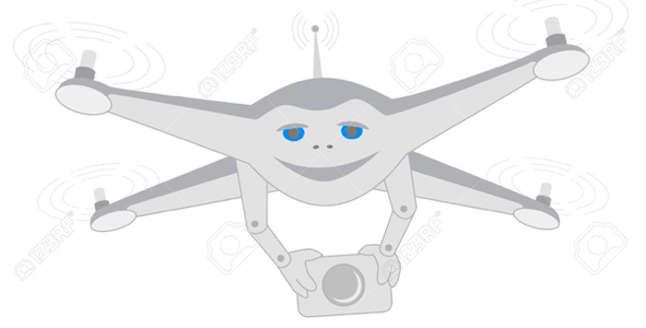
Drone is a control aircraft that is controlled with a certain range and is currently used for many tasks. In our idea of this drone, it was attached to a sensor dedicated to this aircraft with a light weight, where the sensor can sense any change in the oxygen in the air and predict the imminence of a fire through artificial intelligence, where it is Sensing the measurements of gases and taking a direct picture of the place of change and the rate of change, as it sends this data to the control center alerting the change of gases and high temperature. These warnings alert the foresters of any change that may cause forest fires. The environment drone makes reconnaissance tours every two hours and covers a circumference of 2 km from The control tower and landing at the control center No. 2 for shipping and transfer of telecommunications to the second control tower to cover the largest possible area of forests, where it can reduce the occurrence of fires before they occur. The sensors are very accurate with readings and sense of temperature. The plane can be attached to an ultraviolet device and maps to track the arsonists so that Give an ultraviolet image with determination of the location and coordinates of the presence of the cause of fire, whether living creatures or humans, where the aircraft are distinguished The drone is fast moving and easy to control.
he data and information were used to know the real danger in the forests and the huge changes they cause in the geographical structure of the globe, and to know the extent of the change through NASA aerial images, causing breaches and deducing that most of the fires are put out late, which causes the speed of their spread and the difficulty of controlling them. This inspired our team to find solutions To anticipate and control their occurrence and give a clear idea of how to develop the project in the future
https://effis-jrc-ec-europa-eu.translate.goog/?_x_tr_sl=auto&_x_tr_tl=ar&_x_tr_hl=ar&_x_tr_pto=nui
An experience that was very beautiful. I learned to find solutions and work collectively. We faced the difficulties of communication, but we overcame them by meeting and choosing this challenge to compete and develop the world, protect the environment, and contribute even with our ideas to develop and preserve forests and try to use technology and drones with correct uses for the environment. The environment and everyone trying to preserve future generations and natural resources.
https://effis.jrc.ec.europa.eu
https://www.researchgate.net/publication/309184029_Drone_Technology_Types_Payloads_Applications_Frequency_Spectrum_Issues_and_Future_Developments
https://www.youtube.com/watch?v=qAfQ6e_S84g
forests#Drone#Waring#
This project has been submitted for consideration during the Judging process.
Climate change is expected to exacerbate heat-related extremes that impact human health and environmental and ecological systems. Your challenge is to build a tool that uses Earth Observations (EO), crowdsourced data, and models to provide warnings about potential impacts of these events, along with guidance on mitigation measures.